The Earth Observatory has published its last Image of the Day on this website. Please join us on our new home at science.nasa.gov/earth/earth-observatory.
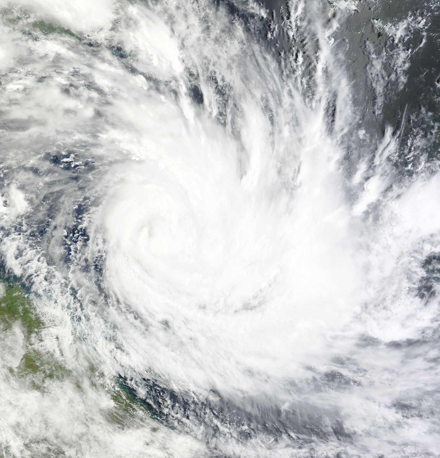
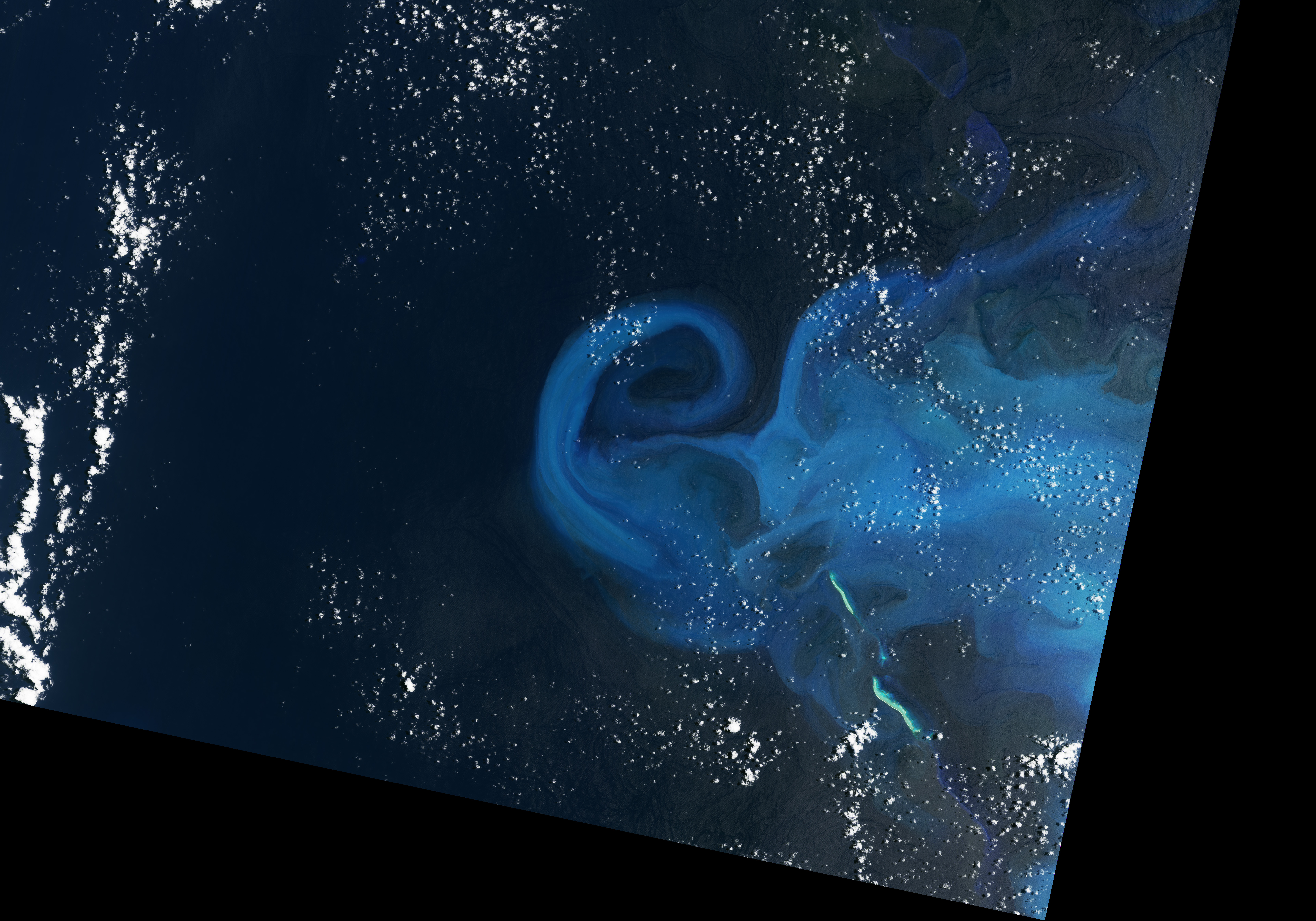
In February 2023, Tropical Cyclone Gabrielle churned south across the Coral Sea and passed over the Bellona Plateau—a shallow area 600 kilometers (400 miles) west of Grande Terre, the principal island of New Caledonia. Once a sizable island during the Pleistocene ice ages, the plateau is now submerged under 25-50 meters of water. It hosts reefs that teem with corals, coralline algae, mollusks, foraminifera, and many other types of marine life with calcium carbonate skeletons or shells.
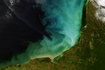
Signs of underwater reefs and carbonate platforms are often subtle in satellite imagery. But Gabrielle’s winds were fierce enough that the storm left a clear sign of the carbonate ecosystem below the water. The passing storm stirred up enough carbonate sediment to temporarily discolor more than 13,000 square kilometers of water, an area about the size of Puerto Rico. Resuspension events of this size are rare at Bellona Plateau, with this being only the second time it has happened at this scale since the launch of the MODIS sensor on the Terra satellite in 1999.
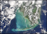
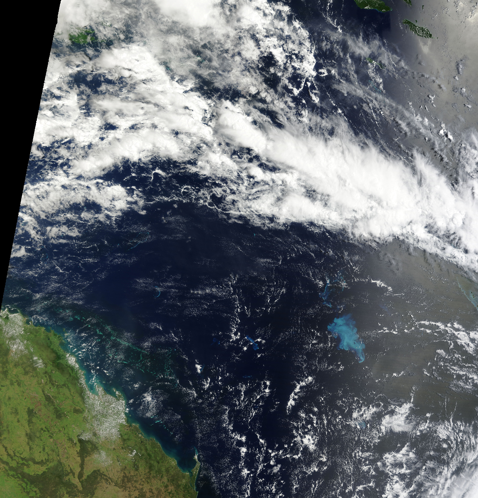
Gabrielle was passing over the area on February 9, 2023, when the Moderate Resolution Imaging Spectroradiometer (MODIS) on NASA’s Terra satellite acquired the first image above. After the storm clouds cleared, the satellite observed carbonate sediment that had become suspended in the water (second image) on February 11, 2023. The sediment drifted in ocean currents over the span of a week, with water over the Bellona plateau returning to its normal color by February 20, 2023.
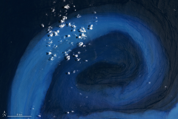
The Operational Land Imager-2 (OLI-2) on Landsat 9 captured the detailed images (below) showing sediment swirling in eddies around the plateau on February 12, 2023. The sediment was likely fine-grained carbonate mud with some larger carbonate sand mixed in. It likely formed due to the erosion and accumulation of bits of coral skeletons, coralline algae, and the hard shells of marine organisms that live on the plateau.
“With the right water chemistry and amount of light, plateaus like this become major calcium carbonate factories,” explained James Acker, an oceanographer with ADNET Systems at the Goddard Earth Sciences Data and Information Services Center (GES DISC). Previous estimates suggest that although shallow coastal areas cover just 7 percent of the ocean’s area, they generate about half of the world’s marine carbonate sediment.
Acker has been using satellites to observe carbonate resuspension events since the launch of the Sea-viewing Wide Field-of-view Sensor (SeaWiFS) in 1997. The goal is to develop better estimates for how much carbonate sediment from shallow areas ends up getting pushed into deeper waters by winds, currents, or other processes.
“Deep ocean water dissolves carbonate muds and sands when they sink,” explained Acker. “That can help counter the ongoing ocean acidification we’re seeing that is caused by the rising levels of carbon dioxide in the atmosphere.” In some cases, depending on the chemistry of the water, carbonates dissolve at depths as shallow as 500 meters. In others, they dissolve at depths closer to 4.5 kilometers.
Estimates suggest that oceans absorb about 30 percent of the carbon dioxide that humans release into the atmosphere. Some of that carbon gets incorporated into shells and sediment and eventually stored as calcium carbonate in limestone and other sedimentary rocks, making carbonate platforms and marine sedimentary rock an important carbon sink.
However, the estimates for how much carbonate these shallow carbonate reefs and plateaus produce, export, and store vary significantly. And there is considerable uncertainty about how the ocean’s ability to store carbon will change as the acidity of the ocean changes. More acidic ocean waters make it harder for many marine organisms to build calcium carbonate shells and thrive, so acidification may reduce how much carbon ends up stored in sedimentary rocks.
The first step to investigating how climate change might be changing the marine carbon cycle is to simply understand and document how much carbonate sediment is cycling between shallow and deep water, explained Acker. That has led Acker and sedimentologist Jude Wilber to examine decades of satellite data to find out if storm and wind events play an important role in this cycling from shallow to deep.
At the American Geophysical Union’s Oceans meeting in 2022, Acker and colleagues presented an analysis of a previous resuspension event that followed Tropical Cyclone Wati hitting the Bellona Plateau in 2006. That event occurred after the Category 4 storm stalled over the plateau for two days and battered it with winds that exceeded 209 kilometers (135 miles) per hour.
“Due to decades of satellite observations—and dramatic examples like this—we can say confidently that tropical cyclones play a very important role,” said Acker. “Nothing else exports the volume of sediment into deeper water that they do. The next step is to demonstrate that in a more systematic and rigorous way by analyzing the entire satellite record with machine learning techniques and getting teams out in the field to better understand the dynamics of transport events.”
NASA Earth Observatory images by Allison Nussbaum, using Landsat data from the U.S. Geological Survey and MODIS data from NASA EOSDIS LANCE and GIBS/Worldview. Story by Adam Voiland.