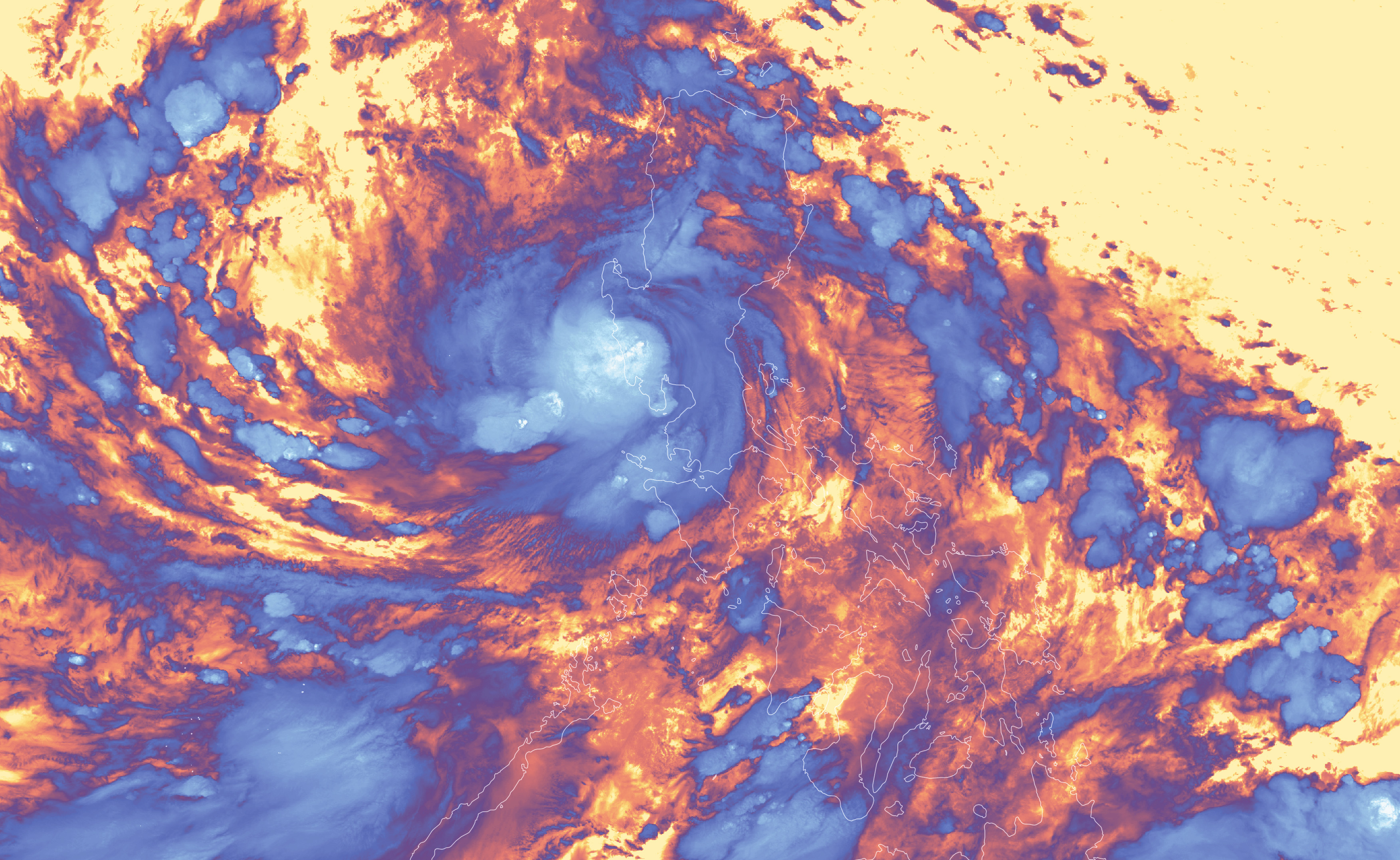
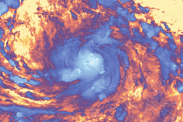
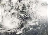
The technical definition of “rapid intensification” of a tropical cyclone is a storm with winds that increase by at least 55 kilometers (35 miles) per hour in a 24-hour period. In the Western Pacific, Super Typhoon Noru (locally called Karding) blew past that threshold. The storm’s winds accelerated from 80 kilometers (50 miles) per hour on September 24 to 250 kilometers (155 miles) per hour the next day. Meteorologists have only recorded a handful of storms that have ever intensified so much so quickly.
Noru made landfall in the Philippines in the evening on September 25 as the equivalent of a category 4 storm. It first hit the Polillo Islands before making a second landfall about 55 kilometers (35 miles) northeast of Manila on the populous island of Luzon. According to news reports, the storm led to at least six deaths, knocked out power to two provinces, and forced tens of thousands of people to evacuate their homes.
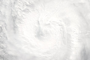
The Visible Infrared Imaging Radiometer Suite (VIIRS) on Suomi NPP acquired this image of Noru on September 25, 2022, a few hours after landfall. Clouds are shown in infrared brightness temperature data, which is useful for distinguishing cooler cloud structures (purple) from warmer surfaces below (yellow). The coolest temperatures (white) are generally associated with the tallest clouds.
Noru weakened as it passed over the mountainous terrain of Luzon, but forecasters expected it to strengthen again to the equivalent of a category 3 storm as it passed over warm waters in the South China Sea. The typhoon could make landfall on September 27 or 28 in central Vietnam. Hundreds of thousands of people in Vietnam were preparing to evacuate in advance of the storm.
NASA Earth Observatory image by Lauren Dauphin, using VIIRS data from NASA EOSDIS LANCE, GIBS/Worldview, and the Suomi National Polar-orbiting Partnership. Story by Adam Voiland.


