The Earth Observatory has published its last Image of the Day on this website. Please join us on our new home at science.nasa.gov/earth/earth-observatory.
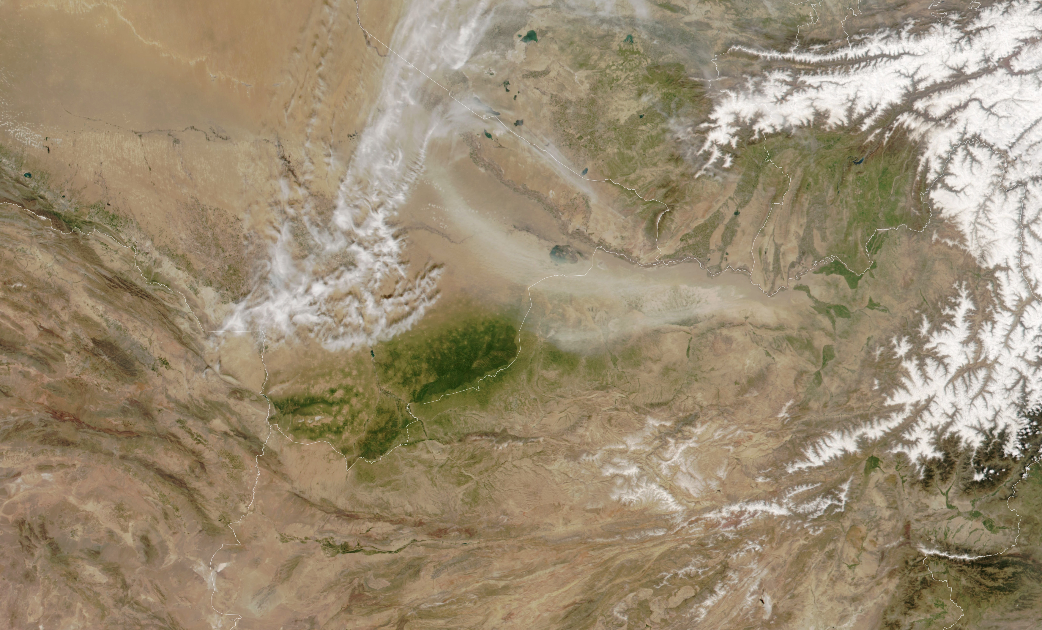
The steppe climate of southeastern Turkmenistan yields freezing winters and dry and sweltering summers. Vegetation typically withers during both seasons, turning the landscape brown in satellite images. Yet for a few months in spring, rains are usually abundant and temperatures moderate enough for the hilly plateau region to become an oasis of green.
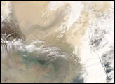
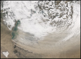
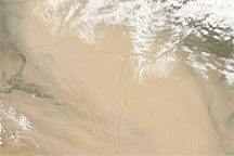
That is what was happening on April 3, 2022, when the NOAA-20 satellite captured this natural-color image of Turkmenistan’s Mary region. Much of the 200 to 240 millimeters (8 to 9 inches) of rain the area receives each year falls between February and May; a prolonged period of dry weather typically sets in by June. During the short growing season, greening desert sedges, grasses, shrubs, and groves of wild pistachio trees transform the landscape.
Dust is another common sign of spring in this region. Cold air masses from the north often clash with intrusions of warm tropical air from the south, yielding unsettled weather patterns that can produce periods of strong, gusty winds. When the satellite acquired this image, winds streamed from the west, plucking particles of dust and clay from the Karakum and Kyzylkum deserts in Turkmenistan and Uzbekistan. Winds also appeared to be lifting dust from a large dune field south of the Amu Dara River in Turkmenistan and Afghanistan.
The region’s drying lakes may have provided extra material for the dust storm. Remote sensing data published in 2021 indicates that many lakes in the region shrank or dried up during the past two decades. Dried lake beds are known for fueling dust storms because they have large amounts of loose dust at the surface.
NASA Earth Observatory image by Lauren Dauphin, using VIIRS data from NASA EOSDIS LANCE, GIBS/Worldview, and the Joint Polar Satellite System (JPSS). Caption by Adam Voiland.