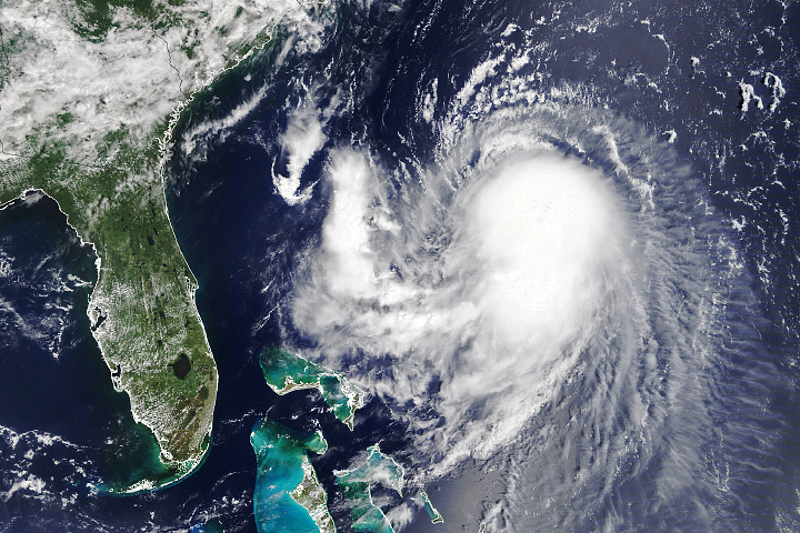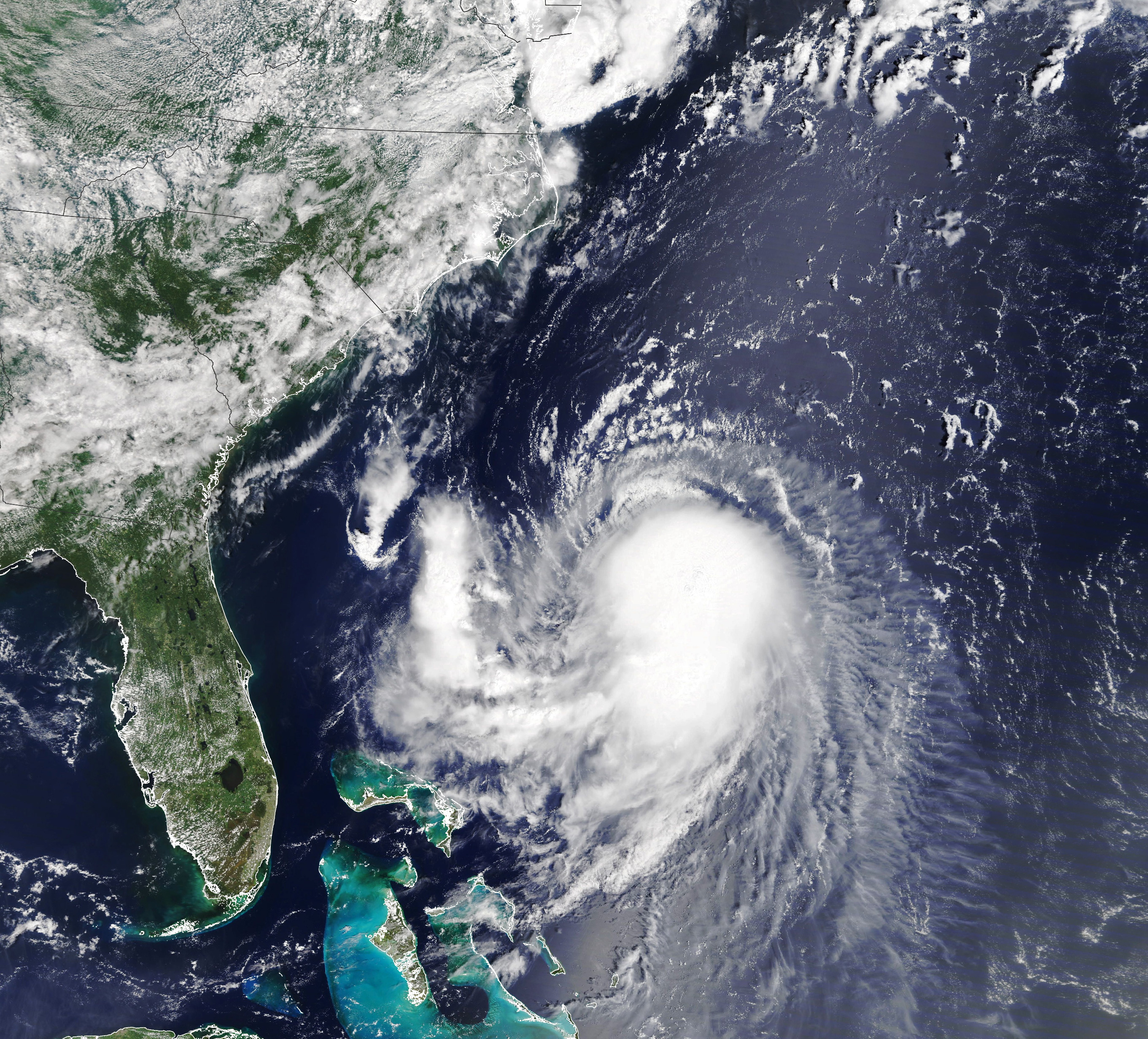
Heavy winds, rain, and storm surge threaten the U.S. Northeast this weekend as Tropical Storm Henri continues to strengthen.
The Moderate Resolution Imaging Spectroradiometer (MODIS) on NASA’s Terra satellite acquired this natural-color image at 11:45 a.m. U.S. Eastern Time (15:45 Universal Time) on August 20, 2021.
Around the time of the image, Henri was located about 400 miles (640 kilometers) southeast of Charleston, South Carolina, and was moving toward the northwest. Sustained winds measured 65 miles (100 kilometers) per hour. That’s 9 miles per hour shy of a category-1 hurricane on the Saffir-Simpson wind scale.
Forecasts called for Henri to turn northward by the evening of August 20 and begin to accelerate, reaching southern New England late on August 22. The storm is expected to strengthen into a hurricane and reach New England with hurricane or near-hurricane strength winds at landfall.
The National Hurricane Center noted on August 20 that a hurricane watch remained in effect for coastal areas of New York, Connecticut, and Massachusetts. A watch indicates that hurricane conditions—sustained winds at or above 74 miles per hour—are possible within the specified areas; in contrast, a hurricane warning indicates that such conditions are expected.
Should Henri reach the southern New England coast as a hurricane-strength storm, news reports say it would be the region’s first direct hit by a hurricane in 30 years.
NASA Earth Observatory image by Lauren Dauphin, using MODIS data from NASA EOSDIS LANCE and GIBS/Worldview. Story by Kathryn Hansen.