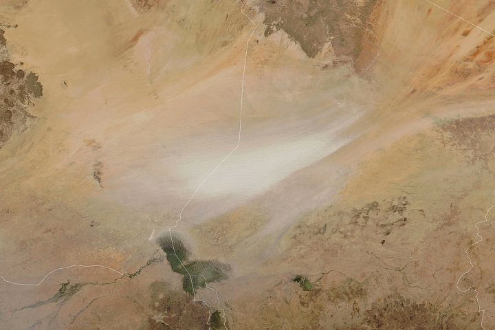
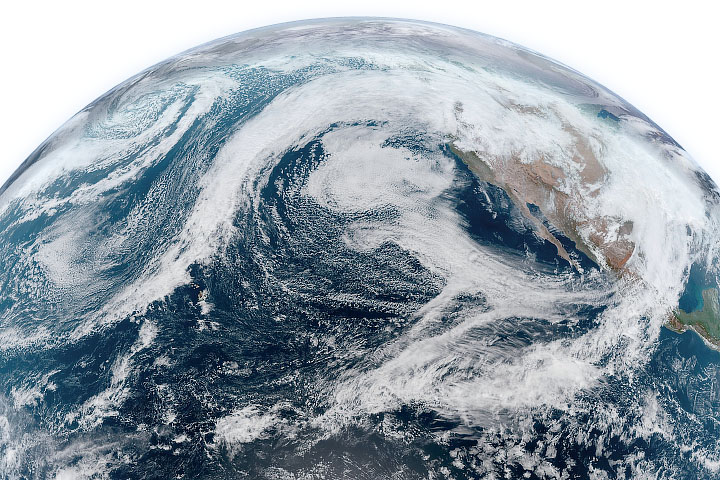
In mid-January 2021, the Pacific Northwest of North America was soaked by several episodes of heavy rainfall, leading to widespread flooding and landslides. The culprit was a phenomenon known as an atmospheric river. And this event was about as extreme as they get.
Atmospheric rivers are long, narrow bands of moisture that move like a river in the sky, carrying water vapor from the equator toward the poles. The events occur around the world, usually during the autumn and winter. The U.S. West Coast is most often affected by rivers of warm, moist air originating around Hawaii.
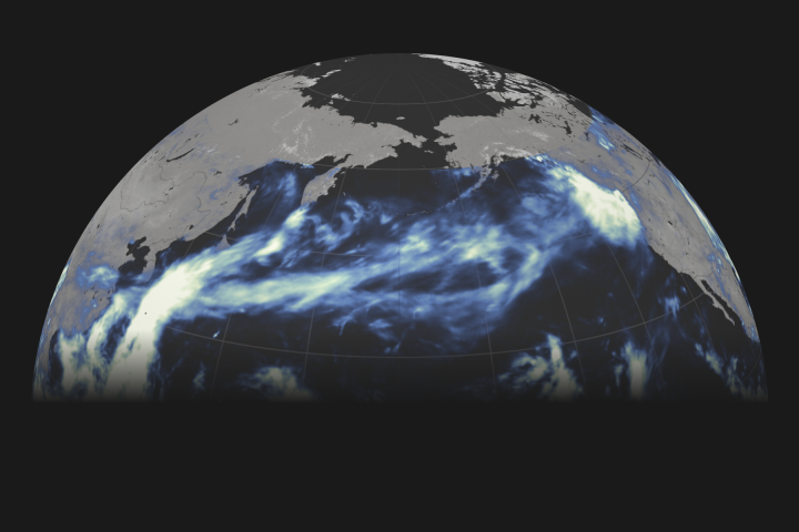
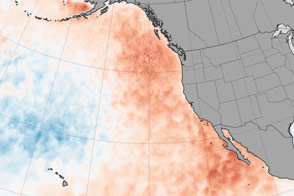
The animation above shows the signature of atmospheric rivers, including a particularly potent event that doused parts of Washington, Oregon, and Northern California. Specifically, it shows the total precipitable water vapor—a measurement of the amount of water in a column of the atmosphere if all the water vapor in that column were condensed into liquid. The animation was derived from a NASA product known as the Goddard Earth Observing System Data Assimilation System (GEOS DAS), which uses satellite data and mathematical representations of physical processes to calculate what is happening in the atmosphere.
Dark blue areas represent the highest amounts of moisture. Note that not all precipitable water vapor actually falls as rain; at least some of it stays behind in the atmosphere. Nor is it a limit on the amount of rain that can fall, which can increase as water vapor moves into a column of air. Still, it is a useful indicator of regions where rainfall was likely to be excessive.
And excessive it was. Between January 11-13, 2021, the heaviest rain fell first on western Washington and northwestern Oregon, followed by a second heavy pulse focused on southwestern Oregon and northwestern California. Some of the highest rainfall totals (more than 10 inches) were recorded on the Olympic Peninsula and the extreme northwest corner of Oregon. Conditions along coastal Oregon were ranked as a category-5 event—the highest on a scale that considers the longevity and the amount of water vapor carried by an atmospheric river. By the end of the animation (January 18), an atmospheric river system appeared to connect British Columbia and southeastern Alaska to Hawaii.
January is a common month for this phenomenon to occur. According to Bin Guan, a researcher at the Joint Institute for Regional Earth System Science and Engineering, a large-scale weather pattern (the Pacific/North American teleconnection) provided favorable conditions during the past month, making it even more likely for atmospheric rivers to form.
Cumulatively, atmospheric rivers supply as much as half of the annual precipitation in the western United States, making them an important contributor to regional water supplies. But if the ground is already saturated, the storms can wreak havoc. Research has shown that more than 80 percent of western U.S. flood damage over a 40-year period was due to atmospheric rivers.
NASA Earth Observatory video by Joshua Stevens, using GEOS-5 data from the Global Modeling and Assimilation Office at NASA GSFC. Story by Kathryn Hansen, with information provided by Bin Guan (JPL/UCLA) and Martin Ralph (UCSD/Scripps Institution of Oceanography/Center for Western Weather and Water Extremes).
alert message