Small, controlled fires have long been a seasonal occurrence in Bolivia. They are routinely used as a tool to maintain pastures, burn off spent crops, clear brush and forest, fertilize soil, and burn trash. But the fires in 2020—like those in 2019—have been anything but routine. They have prompted the government to declare a state of emergency.
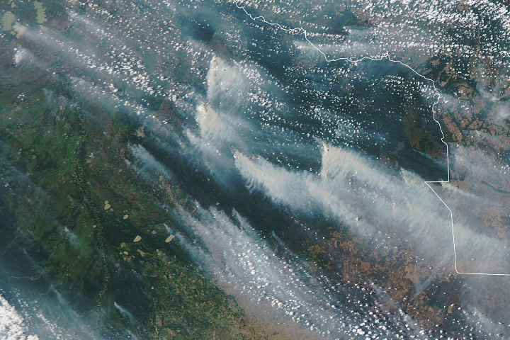
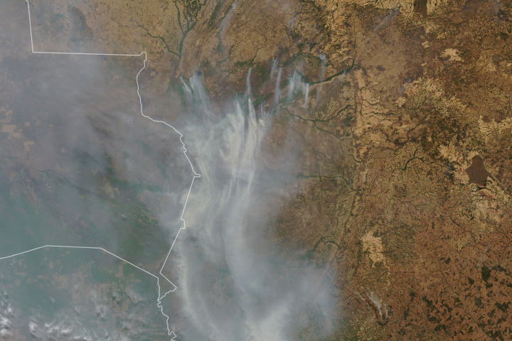
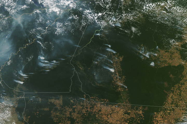
Rather than remaining small and burning for short periods, fires this year have escaped and burned unchecked in several ecosystems, including the Pantanal wetlands in the eastern part of the country; the dry Chiquitano forest in the southeast; and Beni savanna and Amazon rainforest areas in the north. Satellites have observed fires burning throughout August, September, and October, charring large areas and emitting a pall of smoke that has often darkened skies over the region.
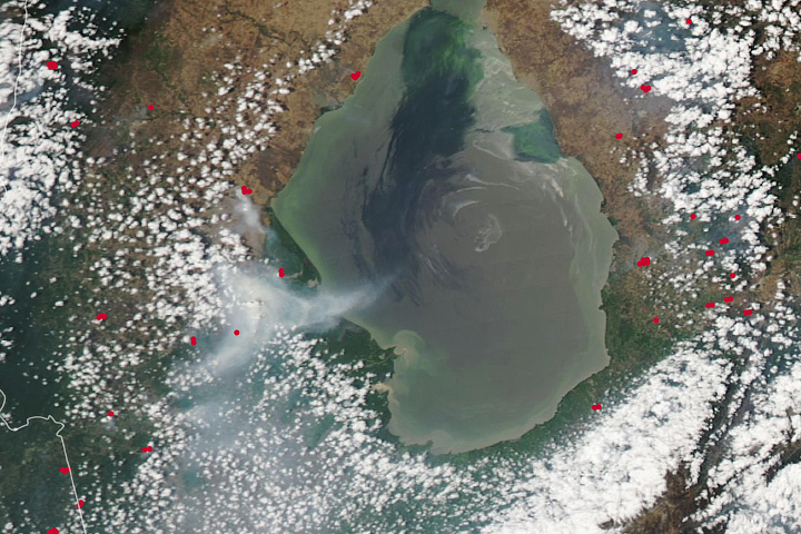
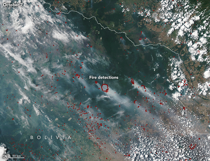
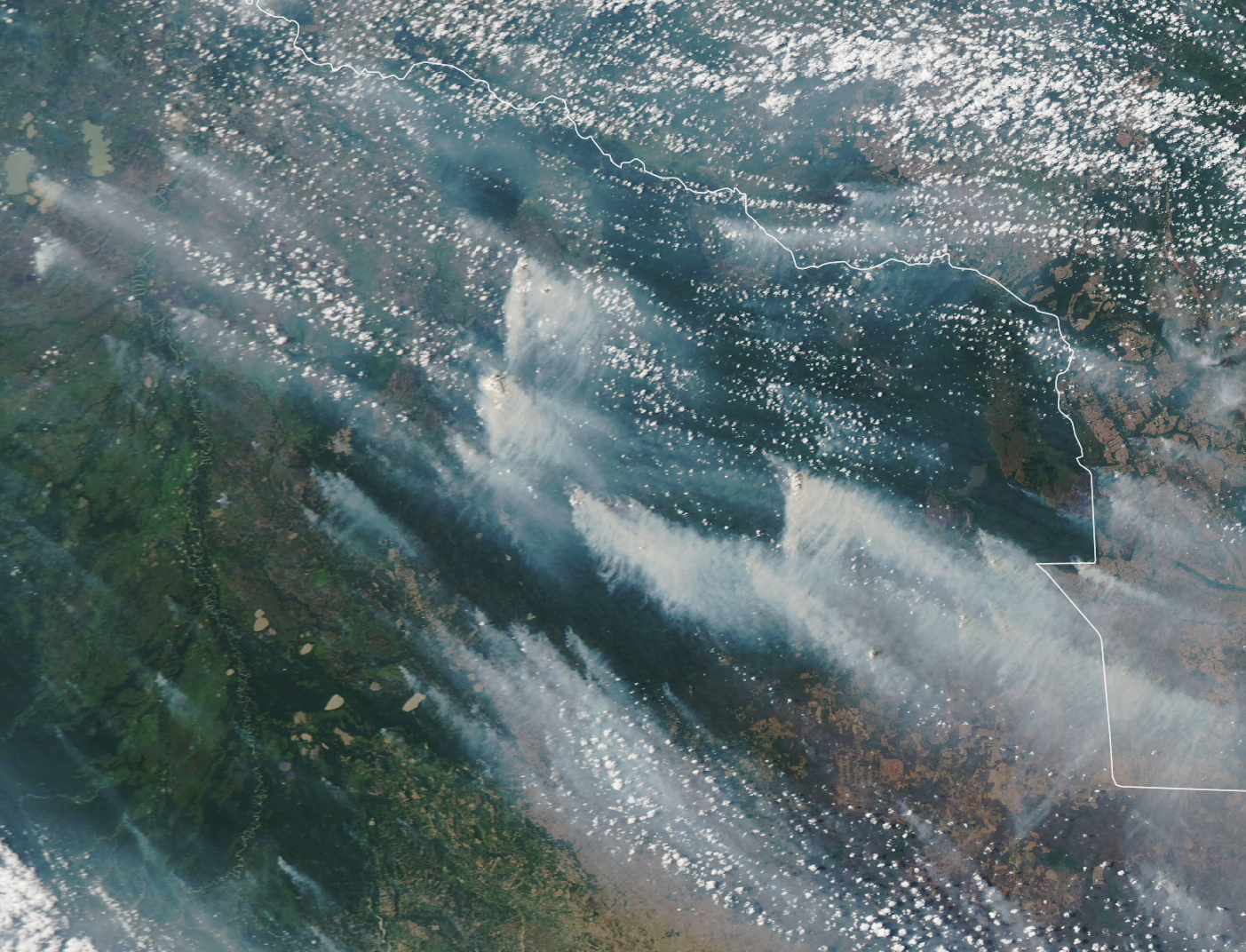
The Moderate Resolution Imaging Spectroradiometer (MODIS) on NASA’s Aqua satellite acquired these natural-color images showing smoke streaming from fires in the Chiquitano forest of eastern Bolivia from October 7 to 10, 2020. The red dots are active fire detections—locations where the Visible Infrared Imaging Radiometer Suite (VIIRS) detected unusually warm temperatures associated with fires. The image below shows the smoke plumes on just October 9.
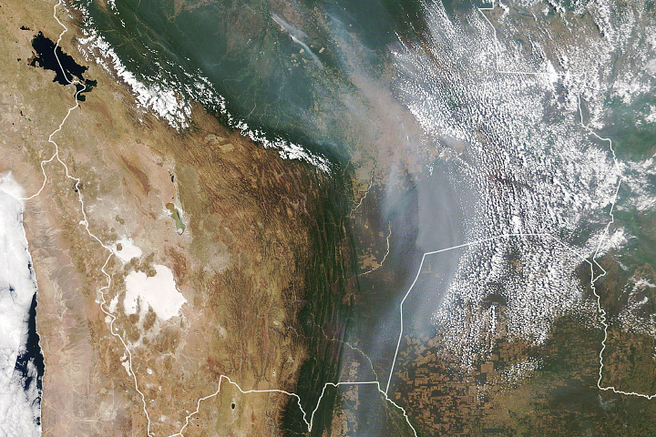
Scientists attribute the extreme fire behavior in Bolivia to a particularly intense and prolonged drought and a recent heat wave that have both turned vegetation into tinder. Warm ocean temperatures in the tropical Atlantic Ocean may be at least partly responsible for the drought; the warmer water tends to shift weather patterns in a way that diverts moisture away from South America into the Northern Hemisphere.
“In the 2000s, severe droughts linked to the warm phase of the Atlantic Multi-decadal Oscillation created conditions where forest fires could burn for months, even in dense Amazon rainforest,” explained Douglas Morton, chief of the Biospheric Sciences Laboratory at NASA’s Goddard Space Flight Center. “This year fits that pattern. As warmer Atlantic sea surface temperatures shifted rainfall to the north, central South America has suffered drought conditions that have put multiple areas at greater risk of wildfires.”
Drought conditions first sparked widespread fire activity in the Parana delta in Argentina in June. That was followed by unprecedented burning in the Pantanal wetlands along the borders of Brazil, Bolivia, and Paraguay in August. Most recently, these fires have flared up in the dry forests of northeastern Bolivia in September and October.
The consequences of the fires have been severe in Bolivia. The government reports that fires have charred more than 1.3 million acres, burning dangerously close to several towns and causing widespread damage to crops and grazing lands. In Santa Cruz and Chuquisaca, fires have collectively destroyed more than 45,000 hectares of crops, 27,000 hectares of grazing land, and 800 head of cattle. According to one analysis of high-resolution commercial satellite imagery by the Monitoring of the Andean Amazon Project (MAAP), 25 percent of the large fires in Bolivia have burned in protected areas, including Noel Kempff Mercado National Park and Copaibo Municipal Protected Area. Relief is not likely to come anytime soon, as weather forecasts predict high temperatures, winds, and little rain in the next few weeks.
Scientists have been tracking the fires in the region and sharing the data with the public via NASA’s Amazon dashboard tool. It shows pronounced increases in the number of savanna and grassland fires in El Beni starting in mid-August. It also detected deforestation and small clearing fires in September in the Amazon rainforest areas of northern Bolivia.
NASA Earth Observatory images by Lauren Dauphin, using MODIS data from NASA EOSDIS/LANCE and GIBS/Worldview and VIIRS data from NASA EOSDIS/LANCE and GIBS/Worldview and the Suomi National Polar-orbiting Partnership. Story by Adam Voiland.