Every year, winds loft about 800 million metric tons of desert dust from North Africa—by far the planet’s largest source of airborne dust particles. The dust is often visible from space during the spring, summer, and early fall, when huge plumes of dry, dusty air from the Sahara Desert (the Saharan Air Layer) blow westward over the tropical Atlantic Ocean.
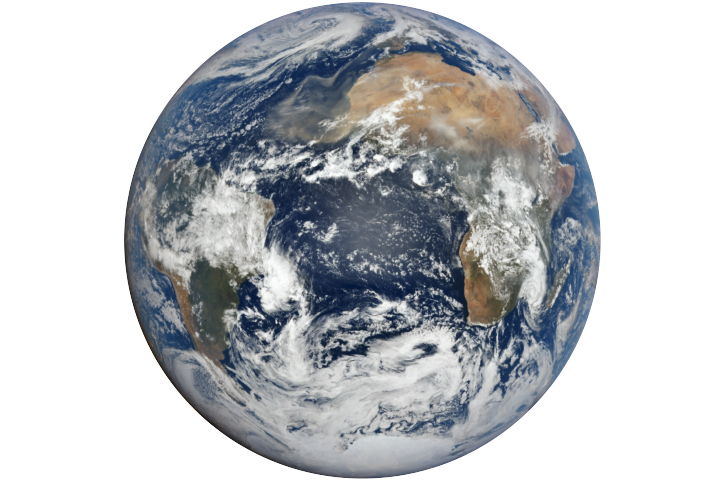
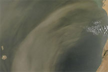
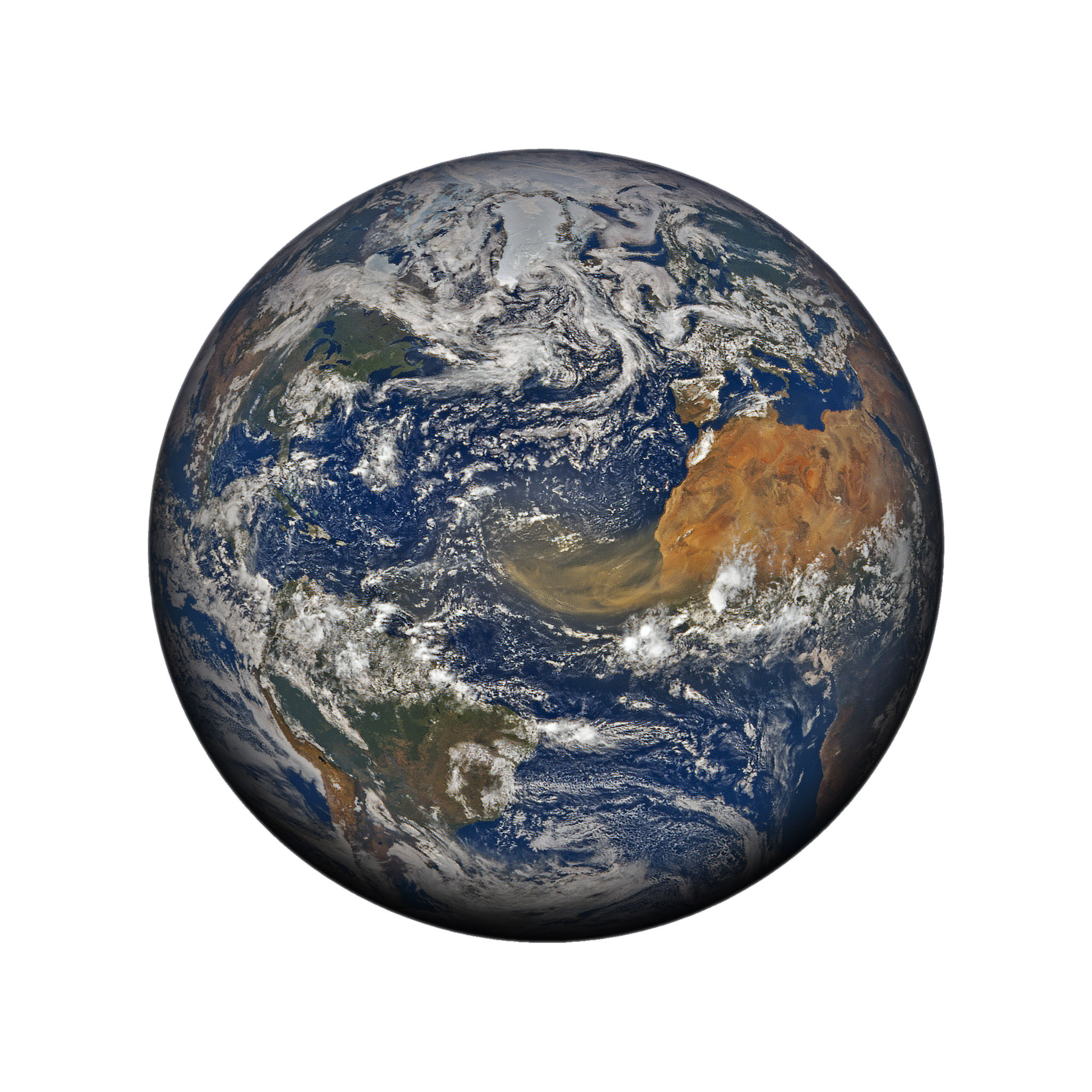
In June 2020, satellites captured these images of a Saharan Air Layer “outbreak” in progress. The top image, acquired June 18 with NASA’s Earth Polychromatic Imaging Camera (EPIC) on NOAA’s DSCOVR satellite, shows the scale of the plume in relation to continents bordering the Atlantic Ocean.

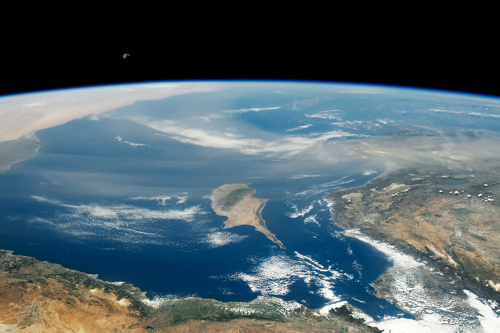
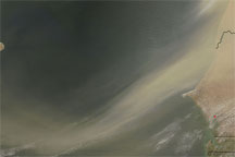
That same day, the Moderate Resolution Imaging Spectroradiometer (MODIS) on NASA’s Terra satellite acquired a detailed view of the dust over the Cape Verde (Cabo Verde) islands. The archipelago, located about 570 kilometers (350 miles) off the west coast of Africa, is frequently in the path of dust plumes.
Summer typically carries a larger volume of dust over the islands, but that dust also tends to float higher in the atmosphere than in other seasons. Still, the volcanic peaks are high enough to alter the air flow and produce patterns in the dust. Notice the v-shaped pattern on the leeward side of the islands. The phenomenon is similar to the v-shaped wake you see behind a boat in a lake or a rock in a stream.
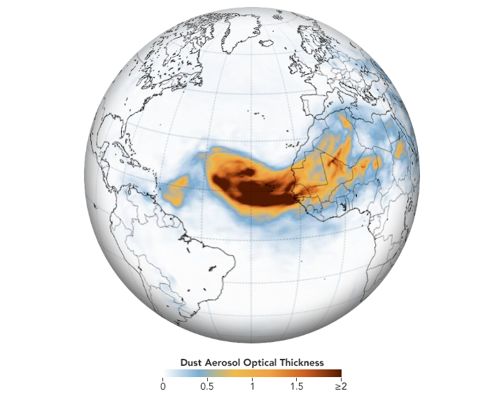
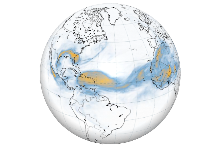
The map above shows the dust on June 18 as represented by the Goddard Earth Observing System Model, Version 5. GEOS-5 is a global atmospheric model that uses mathematical equations to represent physical processes. The map depicts aerosol optical thickness, a measure of the amount of light that the aerosols scatter and absorb, and a proxy for the number of particles in the air. Orange and red colors indicate extremely hazy conditions.
The thickest parts of the plume appear to stretching about 2,500 kilometers (1,500 miles) across the Atlantic. Forecasts indicate that the dust could reach the Caribbean by June 20, and then later drift over the contiguous United States.
Dust from Africa can affect air quality as far away as North and South America if it is mixed into the air near the ground. But the dust plays an important ecological role, such as fertilizing soils in the Amazon and building beaches in the Caribbean. The dry, warm, and windy conditions associated with Saharan Air Layer outbreaks can also suppress the formation and intensification of tropical cyclones.
NASA Earth Observatory images by Joshua Stevens, using MODIS data from NASA EOSDIS/LANCE and GIBS/Worldview, imagery from the Deep Space Climate Observatory (DSCOVR), and data from the Global Modeling and Assimilation Office at NASA GSFC. Story by Kathryn Hansen.