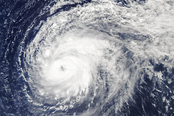
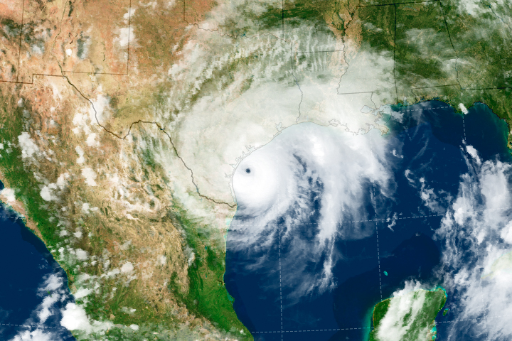
In September 2018, Hurricane Florence lingered in a confined region near the North Carolina coast for 53 hours, becoming the wettest tropical cyclone on record for the Carolinas. In 2017, Hurricane Harvey stalled for more than 100 hours in the northern Gulf of Mexico, pumping disastrous amounts of moisture into Texas. In 2008, Tropical Storm Fay hovered near Florida for at least 66 hours and became one of the most prolific rain-producing storms in the area.
A new study says those stalls were not freak occurrences, but instead fit with a growing trend of slower, longer-lasting hurricanes in the North Atlantic. In a study published on June 3, 2019, scientists from NASA and the National Oceanic and Atmospheric Administration (NOAA) showed that North Atlantic hurricanes have been moving slower and meandering more from their average trajectory over the past seven decades. The result has been storms that stall more frequently and linger for longer periods of time near the coast, leading to more rainfall over confined locations.
“Rain-driven flooding is especially exacerbated by these stalling events,” said Tim Hall, the study’s lead author and a hurricane researcher at NASA’s Goddard Institute for Space Studies. “If a storm sits there for a longer period of time, there’s more cumulative rainfall and much greater flood risk.”
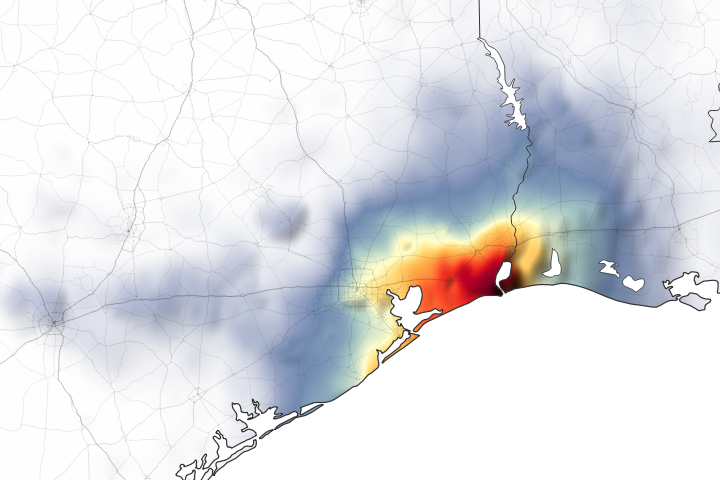
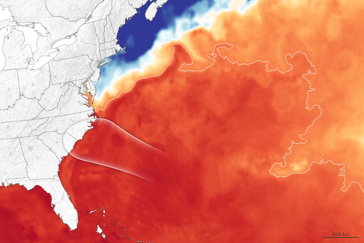
The animation above shows a quintessential example of a stalling storm: Hurricane Harvey. The data, acquired from the National Hurricane Center, shows the path of the hurricane eye as it traveled towards the Houston area. Around August 27, 2017, the storm took a sharp turn to head north. But by August 28, it was moving at just 7 kilometers (5 miles) per hour and wobbling along the south Texas coast. Harvey slowly and steadily dumped the largest amount of rainfall from a tropical system on record for the continental United States.
Looking beyond Hurricane Harvey, Hall and NOAA atmospheric scientist Jim Kossin analyzed all of the tropical cyclones from 1944-2017 in the National Hurricane Center’s HURDAT2 database, which provided the position of each storm center in six-hour increments. For the storms that reached coastal regions, the researchers calculated the average forward speed of each storm. They also examined changes in storm track direction.
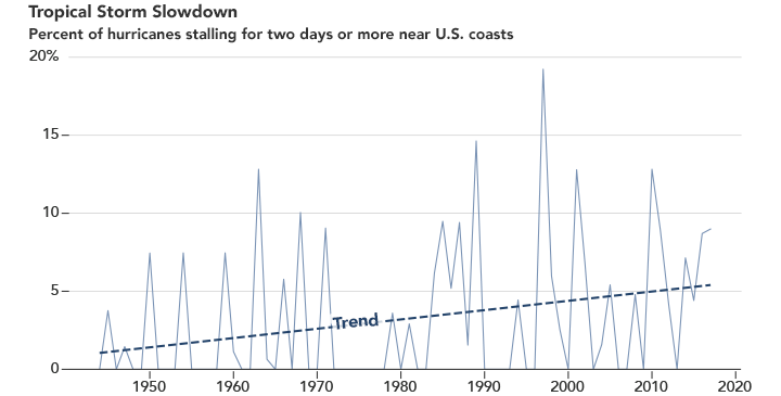
Hall and Kossin found that 66 North Atlantic storms lingered in a coastal region for more than two days. Of these 66 stalls, nearly half occurred in the last third of the 74 years they analyzed; only 17 occurred in the first third. They also found that storms that stalled for longer periods tended to include more meanders. The plot above shows the percentage of coastal hurricanes that stayed within a 200-kilometer radius of the U.S. coast for at least 48 hours.
Out of all of the storms, there was one type that was more prone to meandering and slowing down: storms that were already moving slowly. Looking at rain gauge data, the researchers found that these stalled storms unloaded more rainfall than those that did not.
“You want hurricanes to get out of your neighborhood as fast as possible. So if they’re moving slowly or meandering, that’s very bad for anyone who’s in the neighborhood at the time,” said Kossin. “The main issue is rainfall flooding, which is the number one hurricane hazard in terms of mortality risk.”
Hall, Kossin, and colleagues are still investigating the reasons for the increased stalling in North Atlantic storms, but they suspect it involves weaker winds, which typically steer hurricanes. Like a cork getting pushed by currents in a stream, a hurricane is moved around by large-scale wind patterns in the atmosphere.
“There is some evidence that those large-scale wind patterns are slowing down in the tropics, where Atlantic storms usually start,” said Hall. “The storms are not being pushed as hard by the current that moves them along. That’s a climate change signal.”
One projected effect of climate change is that air masses will move more slowly around the world. As global temperatures rise, the Arctic is warming faster than the tropics—a phenomenon called Arctic amplification. As temperature differences between the tropics and high latitudes decrease over time, so will the difference in air pressure, leading to a reduction in winds.
“If you have a storm that’s sitting in this really strong wind and just barreling along, it’s pretty unlikely to change directions. It would have to run into some very interesting flow that might start to slow it and cause it to start going somewhere else,” said Kossin. “But when a storm is sitting in fairly stagnant air and not really doing much of anything, it’s not terribly hard for it to change its direction.”
NASA Earth Observatory video and imagery by Joshua Stevens, using data from Hall, T. M., and Kossin, J. P., (2019) and IMERG data from the Global Precipitation Mission (GPM) at NASA/GSFC. Story by Kasha Patel.