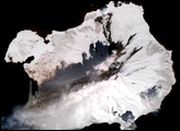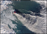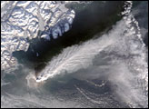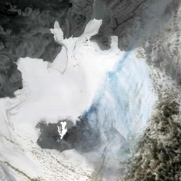
Pyroclastic flows (avalanches of hot ash, pumice, rock, and volcanic gas) poured down the side of the Augustine Volcano in the early hours of February 1, 2006, when the Advanced Spaceborne Thermal Emission and Reflection Radiometer (ASTER) took this image. This nighttime view of the volcano shows the eruption in terms of heat from the thermal infrared part of the electromagnetic spectrum. The hot flows glow as white in contrast to the cold, snow-covered land surrounding them. Ash and steam rise from the volcano, the ash tinting the plume grey-blue. Around Augustine Island, the ocean is warmer than the land surface and so appears white, while clouds are a dingy white and grey.
Sitting in Cook Inlet of southern Alaska, the Augustine volcano is the most active volcano in the Eastern Aleutian arc. According to the Global Volcanism Program, explosive activity at the volcano began on January 11, 2006. Hourly updates on the eruption are available from the Alaska Volcano Observatory.
NASA image created by Jesse Allen, Earth Observatory, using data obtained courtesy of the NASA/GSFC/METI/ERSDAC/JAROS and U.S./Japan ASTER Science Team