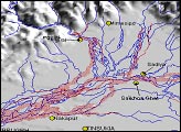
Standing on the ground, it is impossible to gauge the full scope of a disaster the size of the Kosi River floods in northeastern India. On August 18, 2008, the river, swollen with monsoon rains, burst through an embankment into an old channel. By September 2, the river’s course still took it over populated land that had not been prone to flooding in the past. To grasp the full extent of this flood, you need the view from space.
Published Sep 6, 2008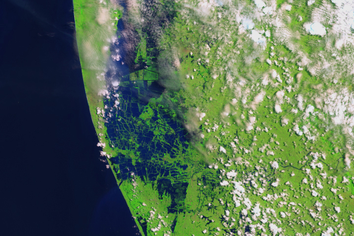
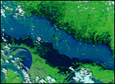
Swollen rivers have altered the landscape in India’s state of Kerala.
Published Aug 24, 2018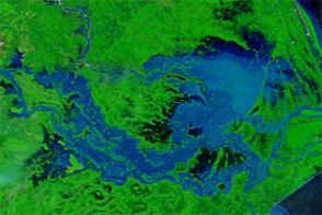
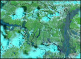
Acquired September 27, 2011, and September 28, 2010, these false-color images compare conditions along the Brahmani and Mahanadi Rivers in India. Severe flooding struck the region in 2011.
Published Sep 28, 2011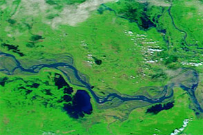
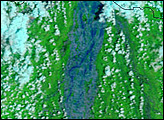
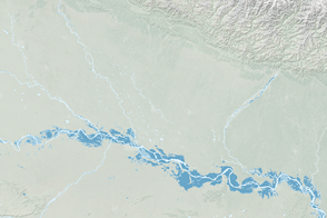
Acquired October 8, 2011, and October 10, 2010, these false-color images compare conditions along a stretch of the Ganga (Ganges) River, where flooding struck in 2011.
Published Oct 10, 2011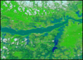
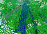
Monsoon rains led to widespread flooding in India along the Ganges River and its tributaries.
Published Sep 10, 2016