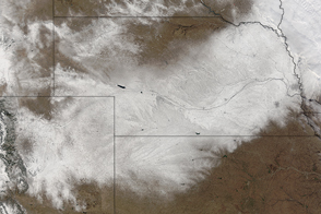
A swath of snow stretches across Colorado, Kansas, Nebraska, Iowa, South Dakota, and Minnesota.
Published Feb 11, 2016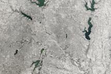
Clear skies allowed the MODIS instrument on NASA’s Terra satellite to capture this view of snow over Dallas, Texas, on February 6, 2011, as the city hosted the Super Bowl.
Published Feb 8, 2011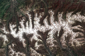
A cold spring and unusually snowy winter led to this uncommon view of winter snow on Utah’s Uinta Mountains in July.
Published Jul 22, 2011
This satellite map of snow cover shows that every state in the contiguous U.S., except for Florida, received snow in January 2011.
Published Feb 25, 2011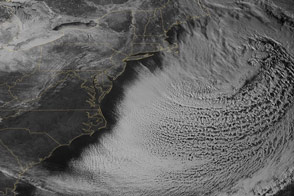
The snowpack near Boston is greater than in all but two reported locations in Alaska.
Published Feb 18, 2015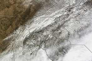
In January 2014, a large storm dropped snow and ice on a part of the United States unaccustomed to wintery weather.
Published Jan 31, 2014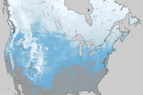
What a difference one year has made in the snow cover over North America.
Published Mar 30, 2012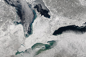
Acquired February 9, 2013, this image shows a blanket of snow left by a nor’easter.
Published Feb 11, 2013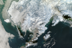
Snow blanketed Alaska, along with much of the continental United States, in early 2017.
Published Jan 11, 2017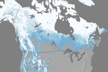
Snow cover across North America in April 2010 was the lowest since records began in 1967.
Published May 27, 2010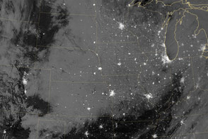
Acquired in the early morning of February 23, 2013, this nighttime image shows snow cover spanning multiple states in the wake of a major snowstorm.
Published Feb 26, 2013alert message
