Satellite measurements recorded the 5th lowest Arctic sea ice maximum extent on record. The top ten smallest maxima have all occurred in the past ten years.
Published Apr 4, 2013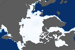
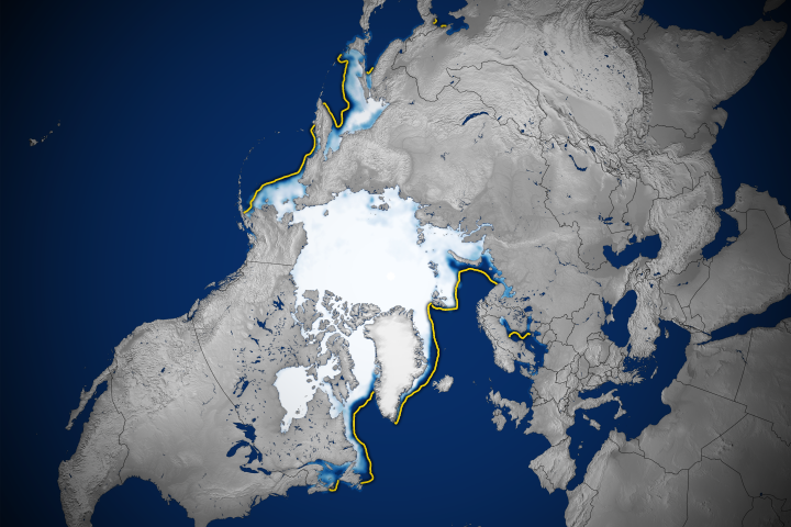
Ice cover in the Sea of Okhotsk and Barents Sea are below normal, while other areas are closer to the average. But the overall trend of shrinking sea ice continues.
Published Apr 10, 2014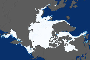
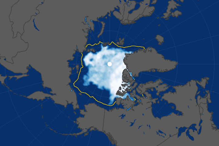
The Arctic ice cap grew less this winter than at any time since satellites have measured it.
Published Apr 8, 2016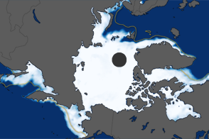
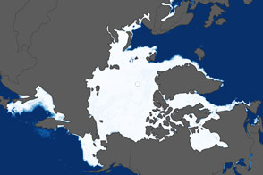
The extent of Arctic sea ice peaked at 15.24 million square kilometers on March 18, 2012. It was the ninth consecutive year of maximum extents below the long-term average.
Published Mar 27, 2012
The amount of Arctic Ocean covered by ice was significantly more than the record low of 2012, but still well below the long-term average.
Published Sep 21, 2013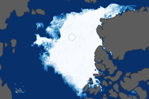
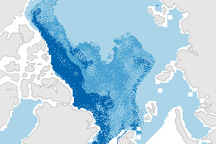
These maps compare Arctic sea ice minimum extents in 1984 (a year with average coverage) and 2012 (the new record low).
Published Sep 27, 2012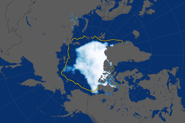
The ice cap tied for the sixth lowest extent on record, continuing a long-term decline.
Published Sep 28, 2018Image of the Day Water Snow and Ice Remote Sensing Sea and Lake Ice
The minimum sea ice extent in 2015 appears to be the fourth lowest in the satellite record.
Published Sep 16, 2015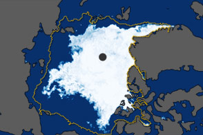
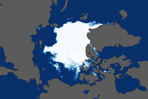
In September 2011, the extent of sea ice covering the Arctic Ocean declined to the second-lowest extent on record.
Published Oct 5, 2011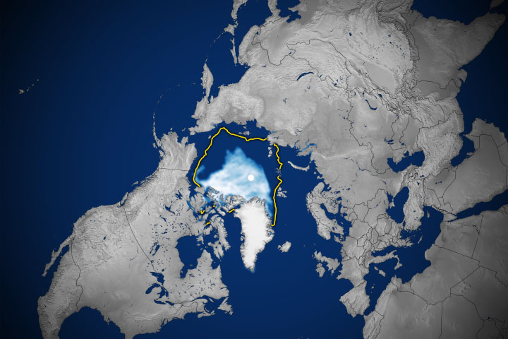
The Arctic sea ice extent continues its long-term downward trend.
Published Sep 22, 2020Image of the Day Heat Land Water Snow and Ice Remote Sensing Sea and Lake Ice
Slight recoveries in the extent of sea ice at both poles were not enough to return to long-term normal levels.
Published Mar 24, 2020Image of the Day Water Snow and Ice Remote Sensing Sea and Lake Ice
Arctic sea ice has been retreating the fastest in the Beaufort Sea.
Published Oct 18, 2017
On September 12, 2009, sea ice reached its annual minimum extent, covering 5.10 million square kilometers (2.97 million square miles) of the Arctic Ocean. This image shows the 2009 ice extent compared to the 1979-2000 average.
Published Sep 19, 2009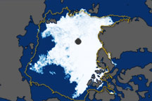
These images show overall Arctic sea ice extent on September 19, 2010 (the date of the 2010 minimum), and sea ice growth in mid-September 2010.
Published Oct 6, 2010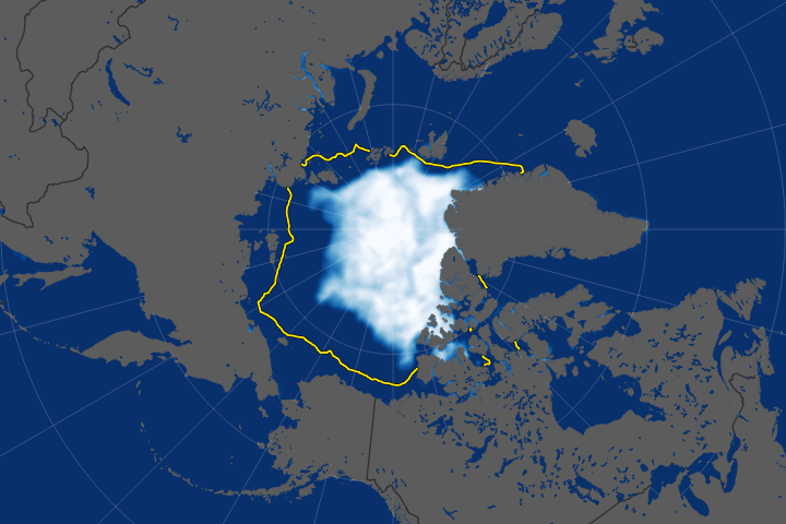
The long-term trend for Arctic sea ice extent has been definitively downward.
Published Sep 23, 2019Image of the Day Heat Water Snow and Ice Remote Sensing Sea and Lake Ice
This pair of maps shows how the sea ice covering the Arctic at winter maximum in 2009 is younger than it was in the past.
Published Apr 10, 2009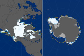
In 2017, the Arctic maximum and Antarctic minimum extents of sea ice plunged to record lows.
Published Mar 23, 2017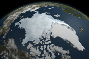
This animation shows Arctic sea ice shrinking to a near record minimum in the summer of 2011.
Published Sep 22, 2011alert message
