Retreating glaciers in the high arctic have left behind heaps of debris and new territory for cold-loving plants to colonize.
Published Jan 18, 2014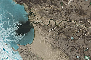
The history of ice can be read on the landscape of Canada's Victoria Island, now home to lakes, rivers...and caribou.
Published Apr 15, 2015
It is so small that you cannot see it on Google maps, but Landsat Island has a unique story of discovery and naming.
Published Apr 10, 2018
Operation IceBridge, an aerial ice surveying mission, has plenty of area to cover.
Published May 9, 2014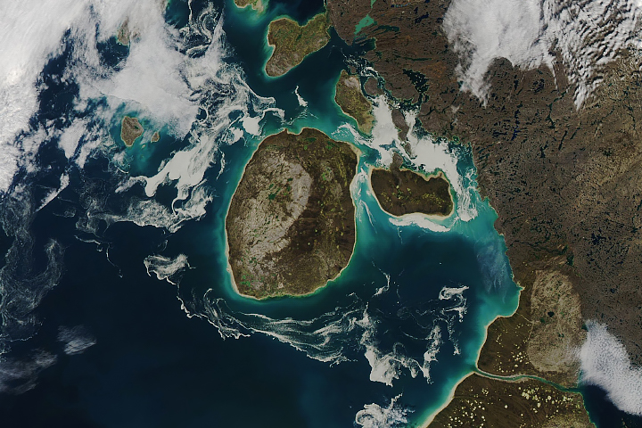
Sea ice that has been tinged brown is common in this part of the Canadian Arctic.
Published Sep 24, 2018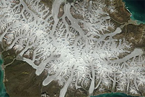
Acquired March 9, 2012, and July 22, 2012, these images show stark differences between winter and summer on Canada’s Bylot Island.
Published Nov 30, 2012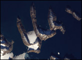
Off the coast of Greenland lies an island resembling a bony claw. Long connected to Greenland’s coast by ice, the island escaped recognition for what it was for nearly a century.
Published Jun 3, 2007
50 trillion pixels of Landsat data give researchers a lot of opportunities to look at Earth processes on scales from days to decades.
Published Apr 16, 2015
Fifty-six images were stitched together to present a seamless mosaic of what the newest Landsat saw on April 19, 2013. Here are some highlights of the satellite tour.
Published May 16, 2013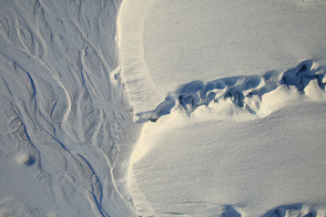
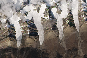
Meltwater has carved sinuous channels on the DeVries Glacier in the Canadian Arctic.
Published Apr 12, 2017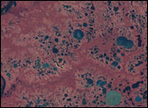
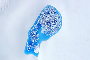
As temperatures rise in summer, turquoise splotches of color begin to speckle the surfaces of Arctic ice.
Published Aug 2, 2014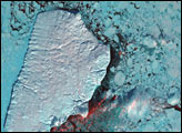
Akpatok Island lies in Ungava Bay in northern Quebec, Canada. Accessible only by air, Akpatok Island rises out of the water as sheer cliffs that soar 500 to 800 feet (150 to 243 m) above the sea surface. The island is an important sanctuary for cliff-nesting seabirds.
Published Feb 25, 2002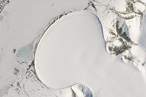
A piedmont-type glacier fans out across a plain in northeast Greenland.
Published Feb 20, 2015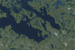
An unnamed isle in Canada’s Nunavut Territory is the leading contender for this island superlative.
Published Feb 22, 2015
The ghostly white shapes northeast and immediately southwest of Wrangel Island are sea ice. Over the course of the satellite record, Arctic sea ice has advanced and retreated past Wrangel Island many times. From 1979 to 2000, the sea ice edge at the end of summer generally fell somewhere in the vicinity of Wrangel Island, but this is not the first summer when the sea ice edge has retreated well north of the island.
Published Aug 29, 2008
An undersea eruption at Lateiki Island in late October 2019 has brought new life to an older island in the Tonga chain.
Published Nov 26, 2019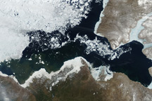
Taken on June 10, 2010, this true-color image captures the western Canadian Arctic in a moment of transformation. Signs of winter are still present, but summer is clearly on the horizon.
Published Jun 16, 2010alert message
