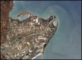
The Ebro River Delta, located along the eastern coast of Spain, is one of the largest wetland areas in the western Mediterranean region.
Published Jul 26, 2004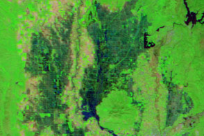
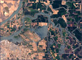
Water flowed into Yolo Bypass, a floodway between Davis and Sacramento, for the first time in three years.
Published Mar 19, 2016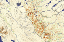
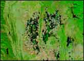
Dark brown squares mark fields that would ordinarily support irrigated crops in California’s Central Valley in this vegetation image. In 2009, a lack of water meant that the crops were not growing well or the fields lay fallow.
Published Aug 16, 2009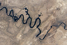
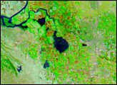
In September 2010, water again flowed through this riverbed after several dry years.
Published Oct 8, 2010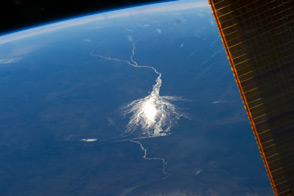
This wetland in the interior of Botswana is an oasis for biodiversity in the midst of the arid Kalahari Desert.
Published Jul 28, 2014
The Colorado River is the largest watershed in the southwestern US, emptying into the Salton Trough before reaching the Sea of Cortez. Over the past 2-3 million years, river sediments built a delta that extends from the US-Mexico border for a distance of 87 miles (140 kilometers). However, today the Colorado River delta is undergoing significant erosion and diminishing in size due to the lack of sediment replenishment from upstream sources.
Published Jun 28, 2004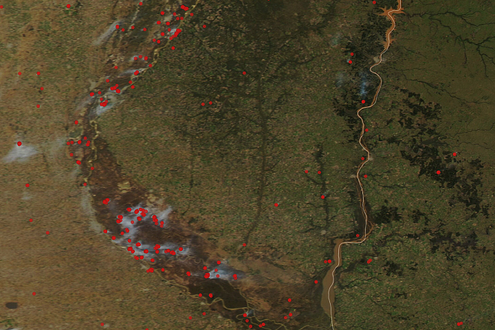
A drought around South America’s second longest river has grounded ships and contributed to a rash of fire in the delta and floodplain.
Published Jul 29, 2020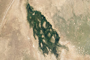
Water travels from the Angolan Highlands to Botswana each year, usually arriving in July. In 2012, the water showed up early, and overflowed into the Savuti River.
Published Jun 5, 2012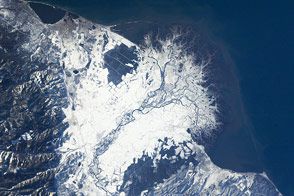
The Selenga River Delta, which stretches out into Russia’s Lake Baikal, is carved by an intricate network of channels and levees and surrounded by marshlands.
Published Nov 28, 2011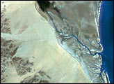
alert message
