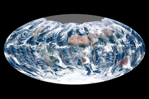
Looking down from 512 miles, the newly launched NPP satellite offers up its first gap-free view of Earth.
Published Dec 16, 2011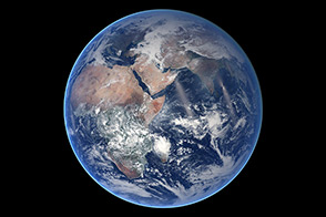
A composite image of Earth is a reminder that NASA’s mission is to study this planet as much as any other.
Published Aug 21, 2014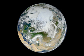
A new composite image built from 15 satellite passes shows the Arctic and northern latitudes as you have never seen them before.
Published Jun 22, 2012
NASA's newest Earth-observing satellite, Suomi NPP, collected the images that went into this new view of our home planet.
Published Feb 4, 2012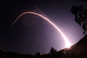
NASA's newest Earth-observing satellite soars into space aboard a Delta II rocket, tasked with improving weather forecasts and continuing long-term climate records.
Published Oct 29, 2011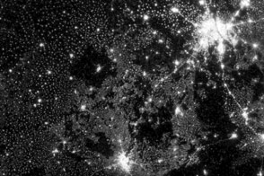
New images from Suomi NPP are an order of magnitude better than previous satellite views of city lights.
Published Dec 14, 2012Image of the Day Land Fires Unique Imagery Human Presence Remote Sensing
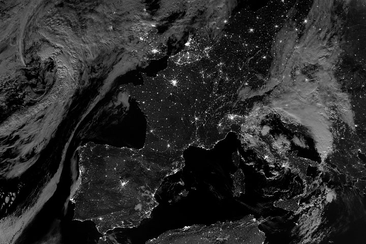
The Suomi NPP satellite got a clear view of Western Europe, its nighttime lights, and its moonlit landscape.
Published Aug 8, 2020
Updated for 2012, this map of lights across America has a least 10 times better resolution than previous maps.
Published Dec 25, 2012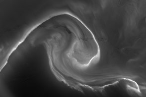
The “southern lights” were bright enough to illuminate the ice below.
Published Jan 1, 2013Image of the Day Atmosphere Fires Unique Imagery Snow and Ice Remote Sensing
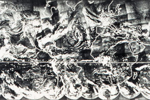
Before there was a Blue Marble photograph or composite image of Earth, there was TIROS IX.
Published Apr 22, 2015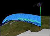
Orbiting the Earth at nearly 17,000 miles per hour, NASA's Ice, Cloud and land Elevation Satellite (ICESat) is collecting spectacular new three-dimensional measurements of the Earth's surface and atmosphere.
Published Dec 10, 2003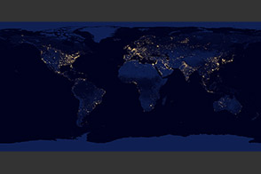
The lights of cities and villages trace the outlines of civilization in this global view.
Published Nov 27, 2012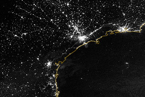
Night life takes on a new meaning when viewed from space.
Published Dec 9, 2012Image of the Day Land Fires Unique Imagery Human Presence Remote Sensing
alert message
