
This pair of images from the Advanced Spaceborne Thermal Emission and Reflection Radiometer (ASTER) on NASA’ Terra satellite shows wide-spread flooding in Oshakati, Namibia, on March 28, 2009.
Published Apr 1, 2009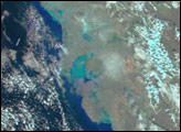
At the northern tip of the island of Newfoundland are the archeological remains of the oldest known European settlement in the New World, L'Anse aux Meadows.
Published Nov 13, 2008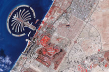
Acquired February 8, 2010, this false-color image shows part of the city of Dubai, including the resort island of Palm Jumeirah. Bare ground appears brown, vegetation appears red, water appears dark blue, and buildings and paved surfaces appear light blue or gray.
Published Mar 12, 2010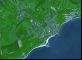
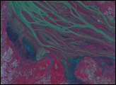
The braided streams of the Betsiboka Estuary have largely returned to their normal size, leaving puddles of blue and green water to show the extent of earlier flooding. Tropical Cyclone Gafilo moved across Madagascar on March 7 and 8, dumping heavy rain in its path. As time passed, the waters eventually flowed down the rivers to the coast, flooding the low-lying land in the west. The Advanced Spaceborne Thermal Emission and Reflection Radiometer (ASTER) on the Terra satellite captured this image of the estuary on March 20, 2004. The false-color image uses green, red, and near-infrared light (ASTER bands 3, 2, 1) so that the main river is green, other water is blue, and vegetation is red.
Published Mar 22, 2004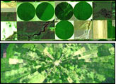
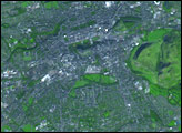
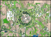
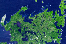
Around the world, agricultural practices have developed as a function of topography, soil type, crop type, annual rainfall, and tradition. This montage of six images from shows differences in field geometry and size in different parts of the world.
Published May 30, 2006alert message
