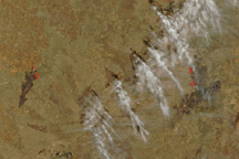
Taken on April 10, 2011, this true-color image shows two large wildfires burning in central Texas near Lubbock.
Published Apr 11, 2011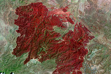
This Landsat image, taken on May 2, 2011, shows all 314,444 acres burned in the Rockhouse Fire in southwestern Texas.
Published May 5, 2011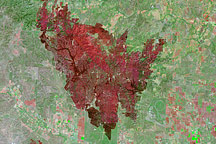
This Landsat image from April 18, 2011, shows land recently burned in Texas’ Wildcat Fire.
Published Apr 27, 2011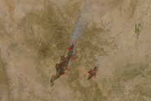
The Rock House Fire stretches in a long line around the town of Fort Davis, Texas, in this true-color image taken on April 10, 2011.
Published Apr 11, 2011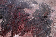
Taken on May 2, 2100, this image shows land burned in the large Rockhouse Fire in southwestern Texas.
Published May 3, 2011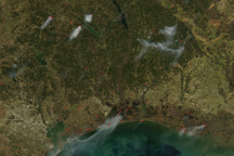
Thick plumes of smoke rise from several fires burning in southeastern Texas and Louisiana in this image from March 1, 2011.
Published Mar 2, 2011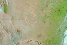
Burn scars dot the state of Texas in this image from April 30, 2011.
Published Apr 27, 2011
The Landsat-5 satellite acquired this image of the Swenson Fire burn scar on April 18, 2011.
Published Apr 27, 2011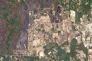
Charred land shows the extent of the Riley Road fire near Magnolia, Texas, in this image taken on September 15.
Published Sep 16, 2011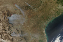
Smoke pours from widespread fires throughout Mexico and Texas in this true-color image from April 27, 2011.
Published May 2, 2011alert message
