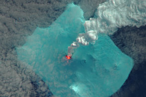
A volcano in the far South Atlantic appears to be erupting for the first time in 60 years.
Published May 10, 2016Image of the Day Heat Land Water Volcanoes Snow and Ice Remote Sensing
Sea ice from the Foxe Basin tends to be rougher and more stained than other parts of the Arctic.
Published May 24, 2014
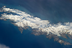
Astronauts capture a view of the South Atlantic Island that looks like it has been taken from an airplane. Mountains and glaciers stand in stark relief against the sea.
Published Apr 29, 2013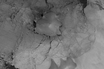
Acquired August 2, 2009, this gray-scale image is made from thermal observations. The image shows that Charcot Island, long connected to Antarctica by the Wilkins Ice Shelf, was circumnavigable in the Southern Hemisphere winter of 2009.
Published Aug 14, 2009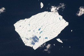
Petermann Ice Island A still behaves like the massive ice sheet it left 14 months ago.
Published Sep 17, 2011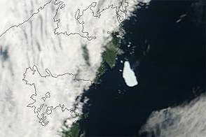
Acquired August 14, 2011, this natural-color image shows the Petermann Ice Island-A off St. Anthony, Newfoundland, where it had apparently grounded a week earlier.
Published Aug 15, 2011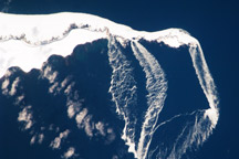
Off the tip of Urup Island, the difference between sea ice and island can be hard to identify.
Published Apr 19, 2010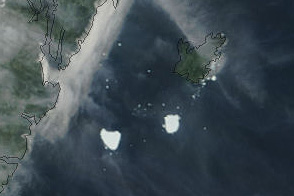
Acquired August 22, 2011, this natural-color image shows the Petermann Ice Island-A split in two off the Newfoundland coast.
Published Aug 23, 2011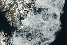
Sea ice formed delicate swirls along the coast of Baffin Island in this true-color image acquired July 11, 2009.
Published Jul 24, 2009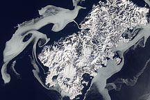
Acquired February 14, 2011, this natural-color image shows sea ice swirling around Shikotan Island at the southern end of the Kuril chain.
Published Feb 20, 2011alert message
