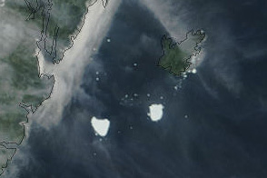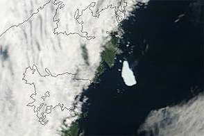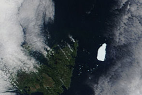

By the time the Moderate Resolution Imaging Spectroradiometer (MODIS) on NASA’s Terra satellite passed overhead on August 22, 2011, the Petermann Ice Island-A (PII-A) had split in two. This natural-color image shows the principal pieces of PII-A off Newfoundland, just south of Bell Island. Coastlines are outlined in black.
Small clouds hover over Newfoundland, appearing as white dots. But while the clouds cast shadows, the smaller white dots around PII-A do not, and they are likely ice fragments floating in the ocean. They may be fragments that came loose during the breakup, or calved off the ice island before or after the split. In the weeks before MODIS acquired this image, the Canadian Ice Service (CIS) reported that PII-A was losing mass due to melting and calving.
PII-A is a remnant of a much larger ice island that calved off the Petermann Glacier in northwestern Greenland on August 5, 2010. Over the course of the following year, that ice island fragmented into smaller pieces, which continued drifting.
NASA image courtesy Jeff Schmaltz, MODIS Rapid Response, NASA Goddard Space Flight Center. Caption by Michon Scott.
Water Snow and Ice Sea and Lake Ice
Acquired August 22, 2011, this natural-color image shows the Petermann Ice Island-A split in two off the Newfoundland coast.
In early August 2010, a massive ice island calved off Petermann Glacier in northwestern Greenland.


