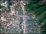
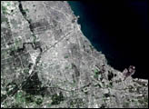
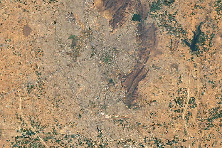
This regional view of Salt Lake City, photographed on 14 June 2003 from the International Space Station, shows the city and its suburbs nestled between the Wasatch Front and the Great Salt Lake.
Published Jul 27, 2003
It is the capital of Utah, headquarters of the Church of Jesus Christ of Latter-day Saints, and “the crossroads of the West.”
Published Jan 6, 2014
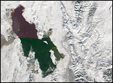
There were few Indian rulers as passionate about architecture as Maharaja Sawai Jai Singh, the founder of Jaipur.
Published Aug 24, 2019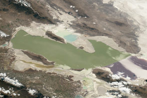
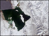
The lake and surrounding landscape are characterized by many flavors and mixtures of salt.
Published Feb 1, 2016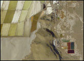
Great Salt Lake serves as a striking visual marker for astronauts orbiting over North America. A sharp line across its center is caused by the restriction in water flow from the railroad causeway. The eye-catching colors of the lake stem from the fact that Great Salt Lake is hypersaline, typically 3–5 times saltier than the ocean, and the high salinities support sets of plants and animals that affect the light-absorbing qualities of the water. Space Station astronauts have recorded the decline in lake levels in response to a regional 5-year drought taking both detailed views and broad views of the entire lake. As lake levels have declined the salt works have become islands in the middle of a dry lakebed.
Published Jan 19, 2004
A photograph from the space station shows some of the natural features that have governed the growth of the city.
Published Dec 22, 2014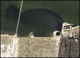
Over the course of just two days, visible progress was being made in pumping floodwaters out of New Orleans.
Published Sep 15, 2005
Lake Sambhar, India’s largest salt lake, sits west of the Indian city of Jaipur (Rajasthan, NW India). On the eastern end, the lake is divided by a 5-kilometer long dam made of stone. East of the dam are salt evaporation ponds where salt has been farmed for a thousand years. This image, taken by astronauts aboard the International Space Station, shows Lake Sambhar’s eastern saltworks in detail. Today, they are operated by a joint venture between Hindustan Salts and the Government of Rajasthan. East of the dam is a railroad, built by the British before India’s independence, that provides access from Sambhar Lake City to the salt works.
Published Dec 13, 2004alert message
