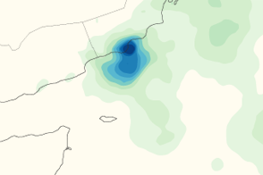
This color-coded map shows rainfall amounts associated with Tropical Storm Keila. The most intense rain occurs along the coast of Oman.
Published Nov 8, 2011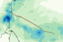
This color-coded image shows rainfall over India, Sri Lanka, and the Bay of Bengal from November 1 to 7, 2010, and the storm track for Jal from November 5 to November 7, 2010.
Published Nov 8, 2010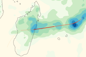
Giovanna brought heavy rains to the east coast of Madagascar, as shown in this color-coded map from early February 2012.
Published Feb 15, 2012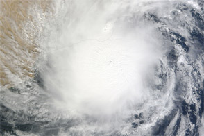
Tropical Storm Keila brought strong winds and heavy rains to the Arabian Peninsula at the beginning of November 2011.
Published Nov 4, 2011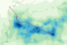
This color-coded image shows estimated rainfall amounts from Tropical Storm Laila from May 17 through May 19, 2010, and the storm track from May 17 to May 20, 2010.
Published May 21, 2010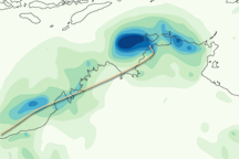
This color-coded image shows rainfall amounts along the northwestern coast of Australia from February 15 to 22, 2011. Heaviest amounts are in dark blue and lightest amounts are in light green.
Published Feb 22, 2011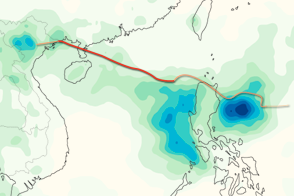
This color-coded image shows rainfall totals and the storm track for Typhoon Kai-tak in August 2012.
Published Aug 20, 2012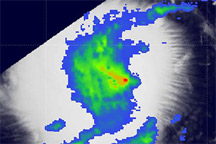
Acquired August 22, 2010, this image shows color-coded rainfall amounts superimposed on a photo-like image of Tropical Storm Danielle.
Published Aug 24, 2010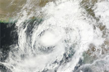
Acquired June 6, 2010, this natural-color image shows Phet along the coastline of Pakistan. The center of the storm is near Karachi.
Published Jun 7, 2010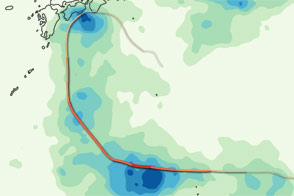
This color-coded image shows the storm track and rainfall amounts associated with Typhoon Ma-on in July 2011.
Published Jul 22, 2011alert message
