Hurricane Bill had a well-formed eye surrounded by concentric bands of rain late on August 17.
Published Aug 18, 2009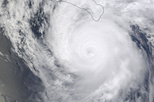
Powerful Hurricane Jimena has well-defined bands of clouds that circle a distinctive eye in this photo-like image from September 1, 2009. The outer bands of the storm were already over the southern tip of Baja California.
Published Sep 1, 2009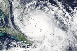
Forecasters expected the third hurricane of the 2015 Atlantic season to follow a trajectory away from the U.S. East Coast, but large amounts of precipitation could not be ruled out.
Published Oct 3, 2015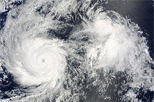
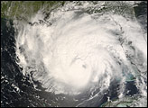
Hurricane Felicia, with its distinct eye and tight bands of spiraling clouds, and the less distinct Tropical Storm Enrique sat side by side over the East Pacific Ocean on August 4, 2009.
Published Aug 6, 2009
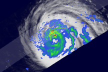
Super Typhoon Choi-wan is formidable in these images, with tightly spiraling bands of clouds and a distinct eye. A vertical cross section of the storm reveals towering clouds and a clear eye surrounded by dense clouds.
Published Sep 17, 2009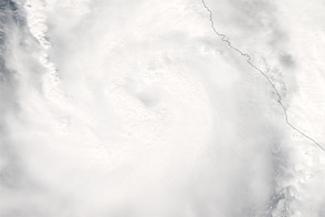
Acquired October 11, 2011, this natural-color image shows Hurricane Jova approaching the coast of Mexico.
Published Oct 13, 2011
Acquired on August 31, 2010, this image combines a grayscale image of Hurricane Earl with a cloud height profile.
Published Sep 2, 2010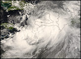

This pair of images from August 22 shows a natural-color (photo-like) view of Hurricane Bill captured by the Moderate Resolution Imaging Spectroradiometer (MODIS) on NASA’s Aqua satellite combined with a view of the vertical structure of the clouds measured by the radar on the Cloudsat satellite.
Published Aug 24, 2009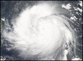
alert message
