Acquired July 7, 2011, and July 4, 2010, these false-color images compare conditions along the Souris River in North Dakota, where record flooding struck in June 2011.
Published Jul 7, 2011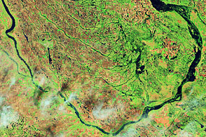
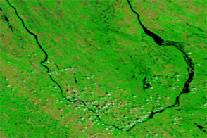
Acquired June 1, 2011, and July 2, 2002, these false-color images compare conditions along the Souris River in North Dakota.
Published Jun 6, 2011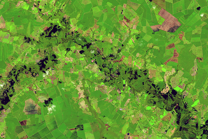
Rivers swelled from the torrential rains of Hurricane Florence.
Published Sep 22, 2018Image of the Day Land Water Severe Storms Human Presence Remote Sensing
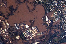
Acquired January 13, 2011 by astronauts aboard the ISS, this photograph shows extensive flooding in the Brisbane suburb of Rocklea.
Published Jan 18, 2011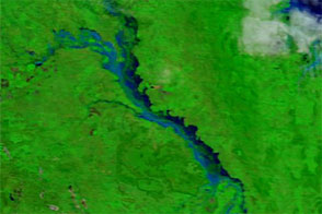
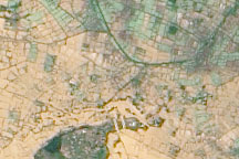
Acquired in late March 2012 and 2011, these images compare conditions along the Isaac River, a tributary of Queensland’s Fitzroy River.
Published Mar 29, 2012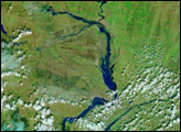
Acquired March 23, 2010, this natural-color image shows an agricultural area immediately south of the Betsiboka River, roughly 40 kilometers from the coast. The beige-and-green area filling most of the image is flooded.
Published Mar 26, 2010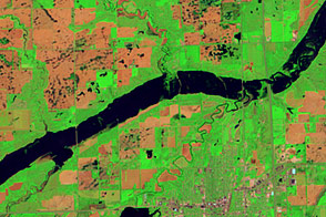
Acquired June 5, 2011, and May 19, 2005, these false-color images compare conditions along the James River near Mitchell, South Dakota.
Published Jun 7, 2011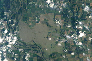
Acquired on June 14, 2011, these images show flooding along the Missouri River near Hamburg, Iowa.
Published Jun 16, 2011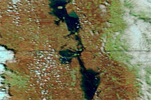
Acquired May 7, 2011, and May 14, 2010, these false-color images compare conditions along the Red River of the North.
Published May 10, 2011alert message
