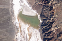
This pair of images from NASA’s Landsat 5 satellite documents the short history of Death Valley’s Lake Badwater: formed in February 2005 and long gone by February 2007.
Published Mar 17, 2009
At 86 meters (282 feet) below sea level, Death Valley, California, is one of the hottest, driest places on the planet.
Published Apr 16, 2006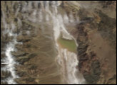
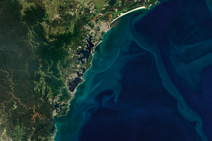
Yet another extreme precipitation event sent rivers out of their banks, inundating coastal towns and prompting evacuations.
Published Apr 8, 2022Image of the Day Land Water Drought Fires Floods Severe Storms Human Presence Temperature Extremes
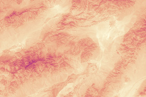
With the thermometer rising past 129 degrees Fahrenheit, Death Valley National Park may have set the record for the all-time hottest June day ever recorded in the United States.
Published Jul 4, 2013
In January 2020, three days of heavy rain led to flash floods across provinces in southern Iran.
Published Jan 15, 2020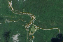
Acquired June 16, 2010, this natural-color image shows sandy deposits along the Little Missouri River that may result from scouring by floodwaters.
Published Jun 18, 2010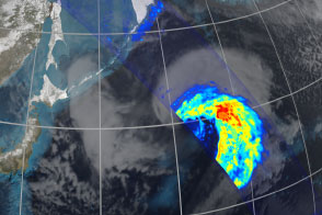
Eleven days after launch, the Global Precipitation Mission acquired this unique view of an extra-tropical cyclone over the North Pacific Ocean.
Published Mar 26, 2014Image of the Day Atmosphere Water Snow and Ice Remote Sensing
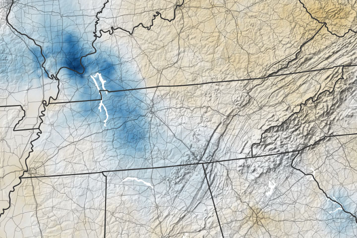
Flash floods occur when persistent heavy rain causes small creeks, channels, and streams to swell rapidly.
Published Aug 26, 2021Atmosphere Land Water Floods Severe Storms Human Presence Remote Sensing
alert message
