From space, the southwest coast of New Zealand resembles the greenstone for which it is named. This cloud-free satellite image is from April 9, 2010.
Published May 22, 2010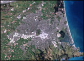
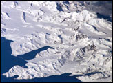
There is no permanent human base on South Georgia Island, a British territory in the South Atlantic Ocean that lies 1,300 kilometers east of the Falkland Islands. The crew of the International Space Station captured this image of the rugged and isolated landscape of the northern shore of the island. The first recorded explorer to land on the island was Captain James Cook aboard the HMS Resolution in 1775. He mapped part of the coastline, but was discouraged by the thick ice cover, lack of vegetation, and steep mountains. Mt. Paget, the highest peak, rises to 2,934 meters (9,625 feet) above sea level, and the island supports 161 glaciers. Cook named the southernmost point of the island “Cape Disappointment” when he realized he had not reached Antarctica.
Published Oct 17, 2005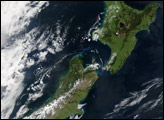
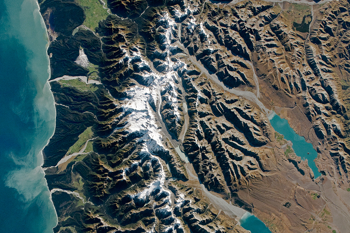
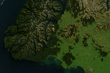
Plate tectonics and glaciers dramatically shaped the landscape of the New Zealand island.
Published May 9, 2021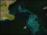
Swirls of iridescent green decorated the South Pacific Ocean east of New Zealand’s South Island on January 5, 2008.
Published Jan 10, 2008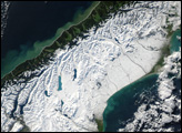
A powerful winter storm swept across New Zealand on June 12, 2006.
Published Jun 17, 2006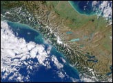
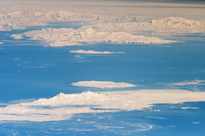
Astronauts on the ISS captured an unusual, airplane-like view of the Antarctic Peninsula and nearby islands.
Published Dec 5, 2011
alert message
