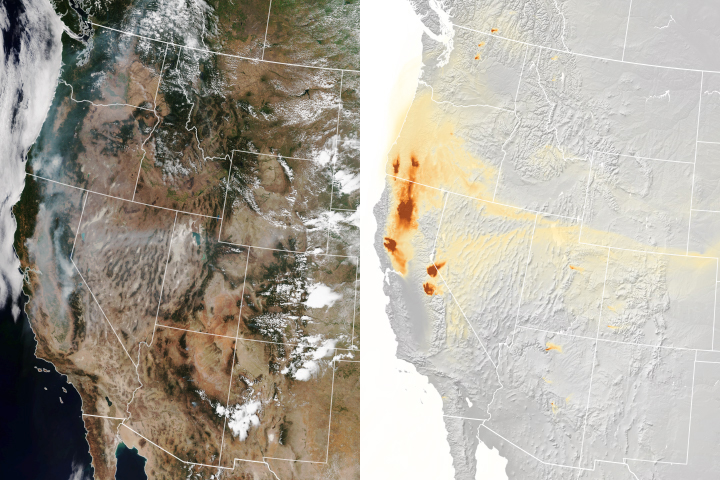
A new experimental model that relies on data from NOAA and NASA satellites has proven remarkably good at simulating the behavior of wildfire smoke.
Published Nov 6, 2018
The height of a wildfire's smoke plume is key to understanding how far it will blow.
Published Jun 6, 2012
With dozens of wildfires burning in a part of Russia best known for its frigid winters, the CALIPSO satellite offered this view through the clouds and smoke.
Published Jul 30, 2014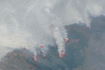
This photo-like image from August 4, 2010, shows intense fires burning across central Russia and a thick plume of smoke stretching about 3,000 kilometers (1,860 miles).
Published Aug 5, 2010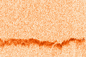
Scientists use a satellite called CALIPSO to study smoke plumes.
Published Jan 18, 2016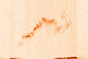
As satellites observed, an intense wildfire in Quebec, Canada, lofted smoke high into the atmosphere in June 2013. Winds then drove the smoke across the Atlantic Ocean all the way to Europe.
Published Jun 28, 2013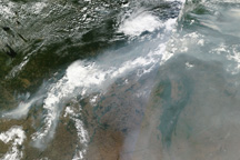
A ribbon of smoke connects two clusters of intense fires in central Russia in this photo-like image from August 12, 2010.
Published Aug 12, 2010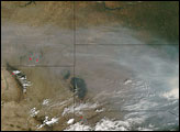
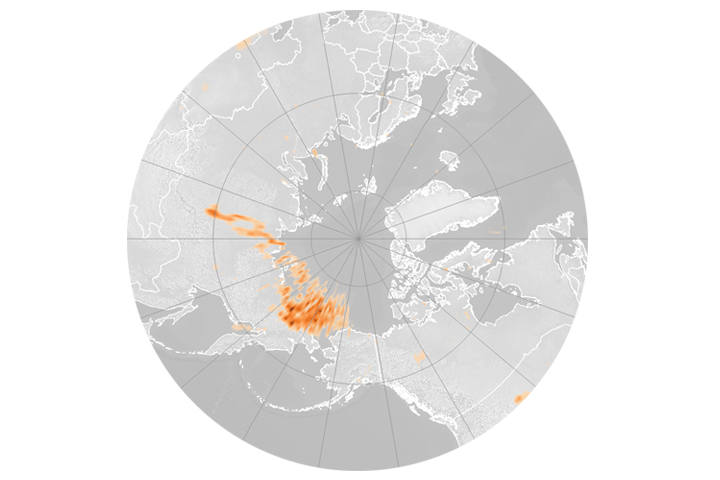
Unusually intense fires in Russia sent smoke half-way around the world.
Published Jul 19, 2018
alert message
