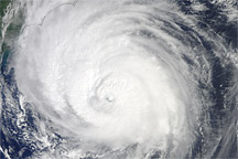
Acquired September 2, 2010, this natural-color image shows Hurricane Earl grazing the North Carolina coast.
Published Sep 3, 2010
Acquired on August 31, 2010, this image combines a grayscale image of Hurricane Earl with a cloud height profile.
Published Sep 2, 2010
Acquired on August 29, 2010, this image combines a natural-color image of Hurricane Earl with a cloud height profile.
Published Sep 2, 2010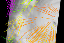
The MISR instrument on NASA's Terra spacecraft captured this image of the wind field inside Hurricane Earl at 11 a.m. EDT on August 30, 2010, when it was a category 3 storm.
Published Sep 2, 2010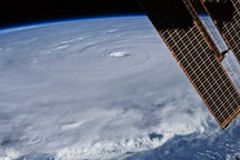
An astronaut on the International Space Station snapped this photograph of Hurricane Earl as a Category 4 storm on August 30, 2010.
Published Sep 2, 2010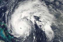
Hurricane Earl is a well-formed storm east of the Bahamas in this true-color image from September 1, 2010.
Published Sep 1, 2010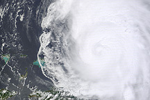
This image shows Hurricane Earl north of Puerto Rico on August 31, 2010.
Published Sep 1, 2010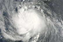
Acquired August 29, 2010, this natural-color image shows Hurricane Earl near the Lesser Antilles.
Published Aug 30, 2010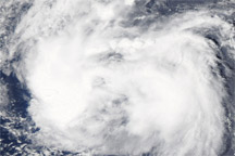
Acquired August 27, 2010, this natural-color image shows Tropical Storm Earl over the Atlantic Ocean.
Published Aug 27, 2010