
Scientists got a glimpse of perhaps the first-ever images of the interaction of shockwaves from two supersonic aircraft in flight.
Published Mar 30, 2019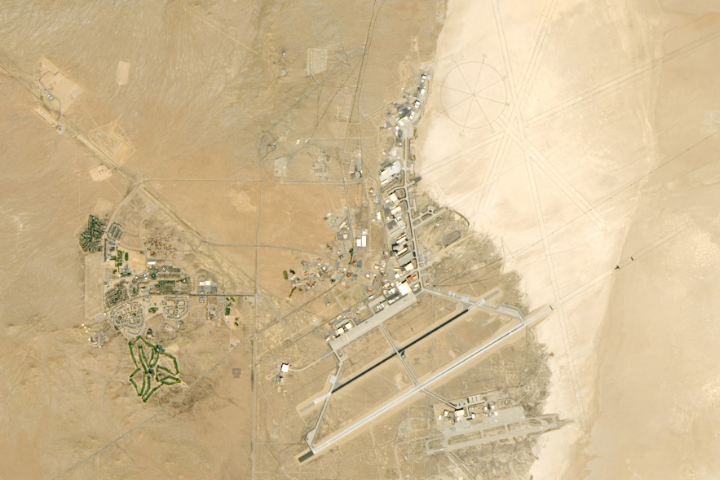
Located alongside a dry lake bed in Southern California, this NASA center has a long history of aviation firsts.
Published Apr 23, 2019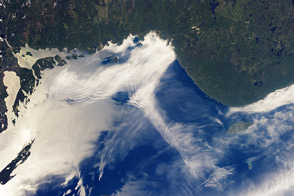
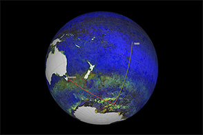
This astronaut view of blending air masses, wind fields, and light reflections is a combination of beauty and of insight about the environment.
Published Jul 22, 2013
An arid region grew even drier between 2003 and 2009 due to human consumption of water for drinking and agriculture.
Published Mar 13, 2013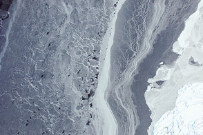
Sea ice in the Amundsen Sea was among the first images acquired by the airborne campaign designed to study Earth's polar ice.
Published Oct 16, 2014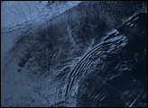
Scientists from NASA are cruising on a research vessel from Tasmania to Tahiti by way of the Southern Ocean. Their objective: gather detailed measurements of Pacific sea water that will be used to validate satellite measurements
Published Apr 5, 2014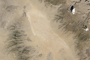
Researchers use ground and airborne instruments, as well as Landsat 7, to calibrate the imagery from the Landsat Data Continuity Mission.
Published Apr 16, 2013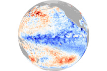
These images show that the central and eastern Pacific Ocean was unusually cold in December 2010, a tell-tale sign of La Niña. The associated rainfall map shows that La Niña was impacting weather in parts of the globe.
Published Dec 24, 2010
Astronauts aboard the Space Shuttle Discovery used the sunglint off the surface of the Mediterranean Sea to reveal biogenic films on the ocean surface (“Biogenic film” refers to a thin layer of biologically-produced film resting on the surface.). The films dampen surface capillary waves, creating brighter and darker reflections, which, in turn, trace the complex surface water movements along the coast. The sunglint also highlights coastal features (jetties, submerged costal areas) near the Port of Suez.
Published Sep 23, 2001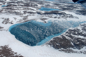
Meltwater accumulates in the rocky terrain near the northeastern coast.
Published May 31, 2012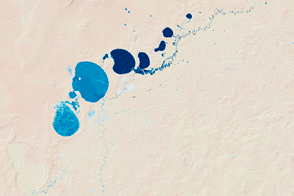
New maps show the fluctuating river and lake levels in the Murray-Darling Basin.
Published Jul 16, 2016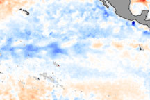
La Niña is an occurrence of unusually cold water temperatures in the Pacific Ocean along the equator (the precise area affected is outlined in black in the image above). La Niña and its opposite, El Niño, are linked to seesaw variations in air pressure over the tropical Pacific and affect weather patterns across the globe. NASA monitors developing El Ni&ntidle;o and La Niña events by observing sea surface temperatures. This image compares the water temperatures observed in late January 2006 to long-term average conditions for that time of year. The recent data were collected by the Advanced Microwave Scanning Radiometer for EOS (AMSR-E). Red shows where sea surface temperatures are warmer than normal and blue where they are colder than normal.
Published Feb 9, 2006