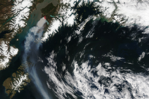
Burning on Alaska’s Kenai Peninsula south of Anchorage, the Funny River fire produced dense smoke that affected air quality throughout the region.
Published May 21, 2014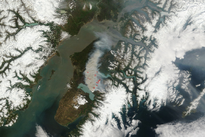
The Funny River Fire burned at least 182,000 acres of southern Alaska forest by May 27.
Published May 27, 2014
This image from June 9, 2011, shows Arizona’s Wallow Fire in the White Mountains near the border with New Mexico.
Published Jun 10, 2011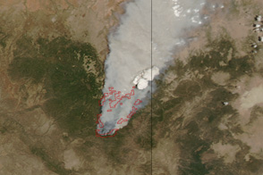
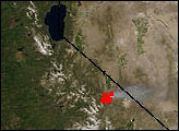
Dense smoke billows from a massive wildfire—the Wallow Fire—in eastern Arizona in this photo-like image from June 4, 2011.
Published Jun 6, 2011
A wildfire in Fresno County, California has burned more than 28,000 acres.
Published Jul 20, 2020
The blaze is the largest in Arizona this year and the largest in the United States right now.
Published Jun 16, 2020Image of the Day Heat Land Fires Human Presence Remote Sensing
The eastern part of the fire was active overnight, expanding the burned area to 76,000 acres.
Published Oct 30, 2019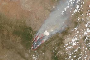
This pair of images shows the vast extent of the Wallow Fire, burning in eastern Arizona, on June 6, 2011.
Published Jun 6, 2011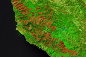
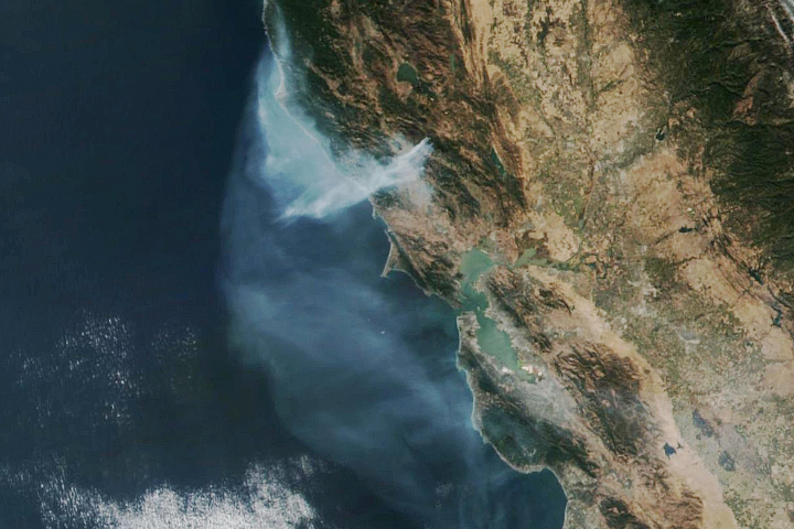
Burning since late July, the Soberanes fire in California has left an extensive mark on the landscape.
Published Sep 21, 2016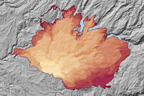
At 369 square miles in size, the Rim Fire is the largest in the United States in 2013.
Published Sep 4, 2013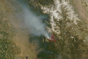
Twenty days after being ignited by lightning, California’s Lion Fire continues to grow.
Published Jul 29, 2011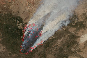
Smoke billows from the Wallow Fire in this natural color image taken on June 8, 2011.
Published Jun 9, 2011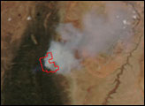

An expansive, destructive wildfire north of Los Angeles is visible from space by day and night.
Published Jun 28, 2016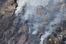
This false-color image illustrates the extent of the Station Fire in southern California.
Published Sep 15, 2009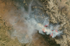
In early September 2015, the Rough Fire was the largest active wildfire in California.
Published Sep 8, 2015