Acquired June 10, 2010, this natural-color image shows a small, white plume blowing westward from the summit of Ulawun Volcano.
Published Jun 10, 2010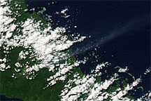
Acquired August 9, 2009, this true-color image shows a faint plume from Bagana Volcano on the island of Bougainville blowing toward the northeast, over the Pacific Ocean.
Published Aug 10, 2009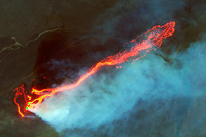
Landsat 8 captured fine details of the lava flowing in Iceland between the Bardarbunga and Askja volcanoes.
Published Sep 10, 2014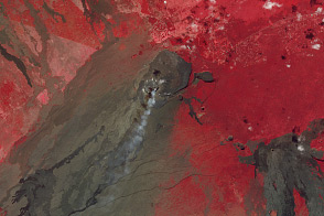
The ongoing eruption at the Hawai’ian volcano is apparent in visible, near infrared, and thermal light.
Published Jan 23, 2013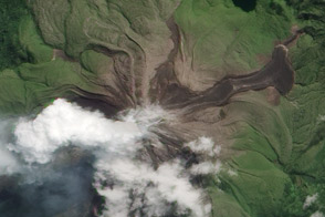
Satellites show the effects of the ongoing eruption at Papua New Guinea’s most active volcano.
Published May 17, 2012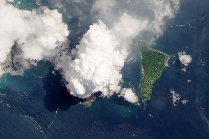
The volcano has been erupting sporadically in 2020.
Published Apr 14, 2020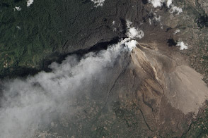
Infrared imagery reveals a pyroclastic flow on the Sumatran Volcano.
Published Mar 11, 2014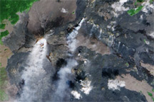
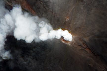
Pu'u 'O'o and the Thanksgiving Eve Breakout vent on Kilauea--two centers of volcanic activity--emit steam and other gases in this satellite image.
Published Nov 5, 2009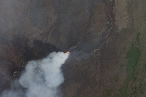
Satellite views show exposed lava and hot spots in Congo.
Published Jan 5, 2012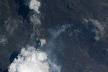
The latest eruption of Piton de la Fournaise Volcano began on October 14, 2010.
Published Oct 29, 2010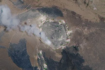
A plume of water vapor, sulfur dioxide, and other volcanic gases continued to escape from Kilauea’s Halema‘uma‘u Crater on July 15, 2010.
Published Jul 22, 2010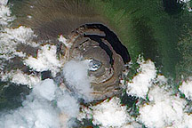
Acquired July 28, 2009, this true-color image provides a relatively clear view of the summit of Nyiragongo Volcano as it releases a faint plume.
Published Jul 29, 2009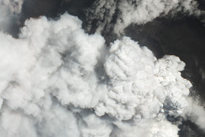
Nabro Volcano emits a dense volcanic plume, rich in water vapor and sulfur dioxide, in this high-resolution satellite image.
Published Jun 16, 2011