As they prepare for a satellite that will measure the height and areal extent of rivers in unprecedented detail, hydrologists have released a better map of North American river widths.
Published Jul 9, 2015
Acquired April 2, 2011, and February 27, 2011, these natural-color images show rising waters on the Kuiseb River, which flowed all the way to the Atlantic Ocean for the first time in decades.
Published Apr 12, 2011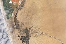
Acquired February 27, 2011, this natural-color image shows pools of water extending from the Kuiseb River to Walvis Bay, Namibia.
Published Mar 22, 2011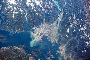
British Columbia's longest river delivers sediment and nutrients to the Strait of Georgia.
Published Jan 7, 2015
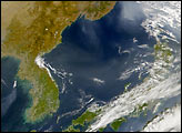
A satellite image offers inky evidence of the organic-rich freshwater that the Suwannee River delivers to the Gulf of Mexico.
Published Oct 27, 2018
The largest river on the planet, the Amazon, forms from the confluence of the Solimões (the upper Amazon River) and the Negro at the Brazilian city of Manaus in central Amazonas. At the river confluence, the muddy, tan-colored waters of the Solimões meet the “black” water of the Negro River. The unique mixing zone where the waters meet extends downstream through the rainforest for hundreds of kilometers, and is a famous attraction for tourists from all over the world. The tourism contributes to substantial growth in the city of Manaus. Twenty years ago the large park near the city center (center) lay on the eastern outskirts of Manaus.
Published Feb 12, 2005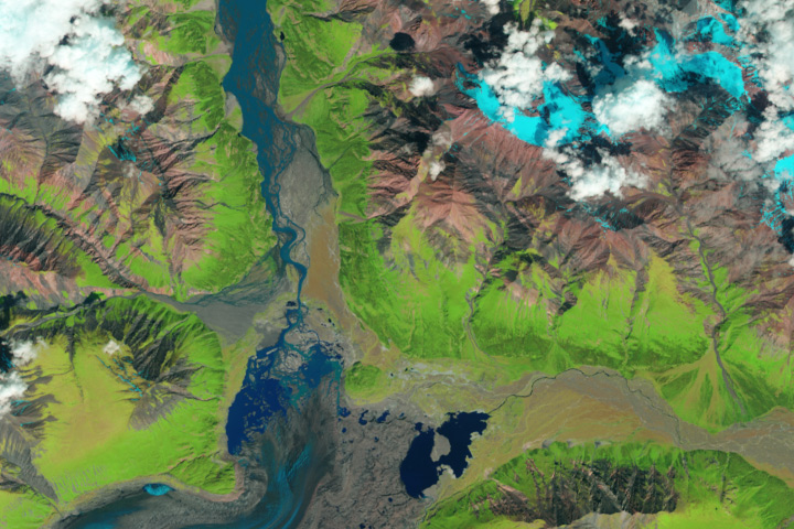
The Kaskawulsh River stole most of the water from the Slims River, dramatically reshaping the region’s drainage.
Published Apr 28, 2017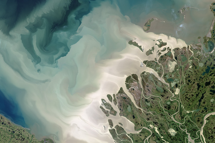
Canada’s largest and longest river delivers vast amounts of fresh water and sediment to the sea.
Published Aug 6, 2017
In the past few centuries, a river in northwestern Canada stopped wandering and assumed a more direct route to the sea.
Published Sep 4, 2012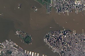
These images from September 12, 2011, and September 2, 2010, compare conditions in the Hudson River near Ellis Island. In the wake of storms, sediment filled the river in 2011.
Published Sep 13, 2011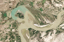
Between 1992 and 2009, a section of the lower Indus River changes course following the formation of an oxbow lake.
Published May 9, 2010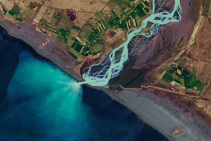
In a country rich with compelling geologic phenomena, even the rivers are connected to the landscape of fire and ice.
Published Aug 6, 2019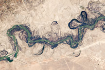
Acquired September 30, 2010, this astronaut photograph shows part of the Syr Darya River Floodplain in Kazakhstan, where the river flows through braided channels.
Published Nov 1, 2010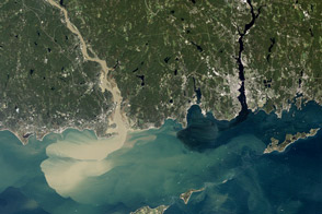
Nearly a week after Hurricane Irene drenched New England, the river was spewing large amounts of muddy sediment into Long Island Sound.
Published Sep 9, 2011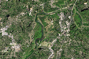
The river supplies Atlanta with its drinking water and a bit of recreational fun.
Published Nov 13, 2016
Floods and new infrastructure have long since separated the distinctive bend in the river that was portrayed by landscape painter Thomas Cole in 1836.
Published Oct 15, 2017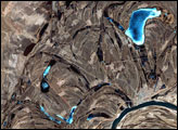
This false-color image from April 1, 2002, shows numerous braided channels and oxbow lakes along the Songhua River in northeastern China, just upstream of the city of Harbin.
Published Dec 27, 2005