Pyramid Lake, in western Nevada, is a remnant of the ancient and much larger Lake Lahontan that formed during the last Ice Age.
Published Oct 18, 2010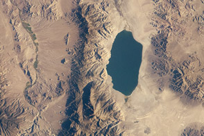
In western Nevada, one of only two remnants of ancient, glacial Lake Lahontan is sandwiched between mountain ridges.
Published Aug 20, 2012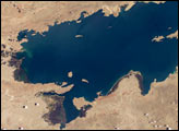
Lake Titicaca, at an elevation of 12,507 feet (3,812 meters) in the Andean Altiplano, is the highest large lake in the world. More than 120 miles long and 50 miles wide, it was the center of the Incan civilization, and today straddles the boundary between Peru and Bolivia.
Published Dec 22, 2003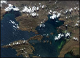
At an average elevation of 3,812 meters (12,507 feet), Lake Titicaca is one of the highest lakes in the world. The lake is positioned between two major ranges of the Andes Mountain chain and has very limited drainage. The limited outflow of the lake allows for the accumulation of nutrients derived primarily from surrounding communities’ agricultural and sewage waste. The increased nutrient levels can lead to plankton blooms. This astronaut photograph, taken from the International Space Station, captures two such blooms along the eastern shoreline of the lake.
Published Sep 20, 2004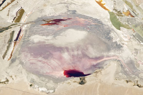
California’s Owens Lake was once part of a much larger lake and river system during the Pleistocene Epoch (about 3 million to 12,000 years ago).
Published Sep 12, 2011
Straddling Austria and Hungary, the lake is also known as the “Sea of the Viennese.”
Published Apr 10, 2017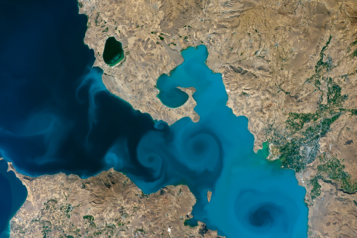
Rich in carbonate species and salts, the basin is the largest alkaline lake in the world.
Published Aug 12, 2018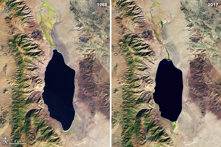
Like this lake in northwestern Nevada, many of the world’s prominent salt lakes are drying up.
Published Apr 4, 2018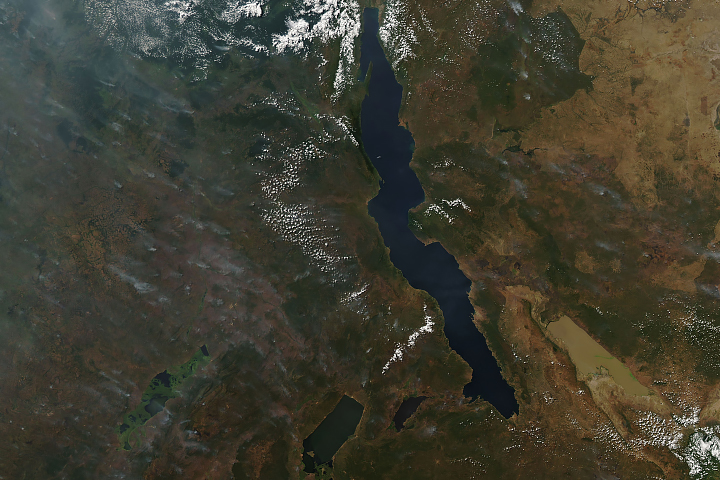
Long and short. Deep and shallow. Salty and fresh. Blue and brown. These are Africa’s Lake Tanganyika and Lake Rukwa.
Published Jun 20, 2019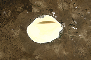
Satellite data suggests this Russian salt lake is getting brighter due to the installation of check dams.
Published Dec 3, 2014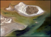
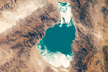
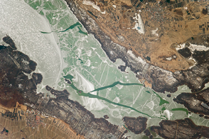
Lake Poopó sits high in the Bolivian Andes, catching runoff from its larger neighbor to the north—Lake Titicaca (not shown)—by way of the Desaguadero River, which is the muddy area at the north end of the lake. Because Lake Poopó is very high in elevation (roughly 3,400 meters, or 11,000 feet above sea level), very shallow (generally less than 3 meters, or 9 feet), and the regional climate is very dry, small changes in precipitation in the surrounding basin have large impacts on the water levels and area of Lake Poopó. When the lake fills during wet periods, it drains from the south end into the Salar de Coipasa salt flat (not shown). Water levels in Lake Poopó are important because the lake is one of South America’s largest salt-water lakes, making it a prime stop for migratory birds, including flamingoes.
Published Apr 24, 2006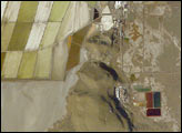
Great Salt Lake serves as a striking visual marker for astronauts orbiting over North America. A sharp line across its center is caused by the restriction in water flow from the railroad causeway. The eye-catching colors of the lake stem from the fact that Great Salt Lake is hypersaline, typically 3–5 times saltier than the ocean, and the high salinities support sets of plants and animals that affect the light-absorbing qualities of the water. Space Station astronauts have recorded the decline in lake levels in response to a regional 5-year drought taking both detailed views and broad views of the entire lake. As lake levels have declined the salt works have become islands in the middle of a dry lakebed.
Published Jan 19, 2004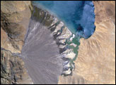
Meltwater from glaciers to the east and west drains into Lake Morari, a large lake that lies at an altitude of 4,521 meters (14,830 feet) on the Tibetan Plateau. A stream on the west side provides the lake’s main inflow. Mud from this river gives the light blue hues to the lake water. The well-formed alluvial fan (image center), built by sediment from the main inflow river, is the reason the lake has formed at this point in the valley.
Published Dec 18, 2006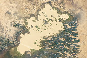
In the desert, a lake shows a long fight between water, wind, and climate.
Published Feb 20, 2012