Acquired June 23, 2011, and June 24, 2010, these false-color images compare conditions along the Souris River in North Dakota.
Published Jun 23, 2011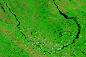
Acquired July 7, 2011, and July 4, 2010, these false-color images compare conditions along the Souris River in North Dakota, where record flooding struck in June 2011.
Published Jul 7, 2011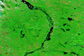
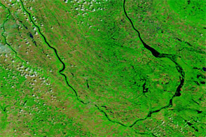
Acquired August 7, 2011, and July 7, 2011, these false-color images compare conditions along the Souris River, which flooded in the summer of 2011.
Published Aug 8, 2011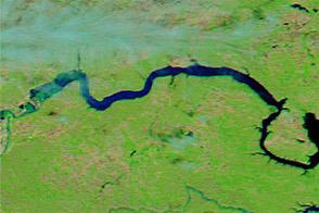
Acquired June 1, 2011, and June 4, 2010, these false-color images compare parts of the Missouri and Souris Rivers.
Published Jun 2, 2011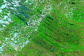
Acquired June 18, 2011, and June 15, 2010, these false-color images compare conditions along the Souris River in the United States and Canada.
Published Jun 20, 2011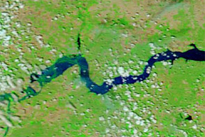
Acquired June 11, 2011, and June 4, 2010, these false-color images compare conditions around Williston, North Dakota, during the 2011 floods and the year before.
Published Jun 13, 2011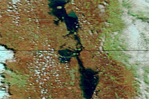
Acquired May 7, 2011, and May 14, 2010, these false-color images compare conditions along the Red River of the North.
Published May 10, 2011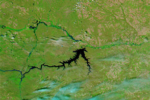
Acquired June 5, 2011, and June 16, 2010, these false-color images compare conditions along the Milk, Souris, and Missouri Rivers in Montana and North Dakota.
Published Jun 6, 2011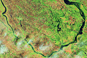
Acquired June 1, 2011, and July 2, 2002, these false-color images compare conditions along the Souris River in North Dakota.
Published Jun 6, 2011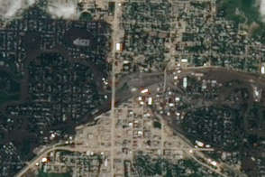
Acquired June 25, 2011, this image shows widespread flooding in the city of Minot, North Dakota, as the Souris River was reaching a historic crest.
Published Jun 30, 2011