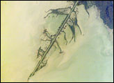
The Ural River is one of the two major rivers (the other is the Volga) that empty into the northern coast of the Caspian Sea, creating extensive wetlands. This image shows details of the Ural’s tree-like (or “digitate”) delta. This type of delta forms naturally when wave action is low, and sediment content in the river is high. New distributary channels form in the delta when the river breaches natural levees created by sediment deposition. The long main channel of the river in this image and several of the distibutary channels are too regular to be entirely natural, however. Like the famous Mississippi River delta in the United States, the Ural River delta has been significantly modified to reduce flooding and divert water.
Published Jun 6, 2005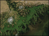
The inland sea in Central Asia has a host of distinctive features along its shores.
Published Oct 24, 2016
The Volga River drains much of western Russia’s industrial region as it travels southward to empty into the Caspian Sea. Over thousands of years, the river has built a tremendous delta that forms the northwestern shoreline of the Caspian Sea. The delta channels provide transportation between the heartland of Russia and the oil-rich Caspian Sea. The Volga’s extensive distributaries (branches to the sea) harbor habitat and rich fishing grounds for Russia’s famous beluga sturgeon, the source of beluga caviar. The delta’s wetlands, parts of which are designated as the Astrakhanskiy Biosphere Reserve, are important stopping points and breeding grounds for migrating water birds. This detailed astronaut photograph zooms in on a shipping channel in the western part of the delta.
Published Oct 23, 2006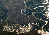
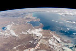
The approximate boundary between Europe and Asia is defined by the Ural River and the Ural Mountains to its north. The Ural River flows to the great inland Caspian Sea and gives its name to the city of Uralsk on its banks. International Space Station astronauts acquired a series of images of Uralsk, highlighting the city under different lighting conditions. This view shows the sunglint (light reflected from the water surface towards the observer) on the rivers, lakes, and ponds of the Ural flood plain (right side of image) and that of a tributary, the Chogan River (bottom). The cityscape of Uralsk, on the headland between the two, is relatively difficult to see because the water and sunglint dominate the scene.
Published Nov 14, 2005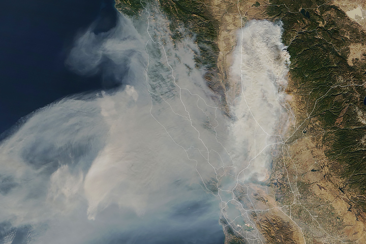
A satellite sensor is helping scientists understand where smoke is headed and what it means for those breathing it.
Published Mar 14, 2019
In the past few centuries, a river in northwestern Canada stopped wandering and assumed a more direct route to the sea.
Published Sep 4, 2012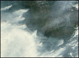
Smoke and natural wonders fill this scene shot from the International Space Station.
Published Sep 30, 2012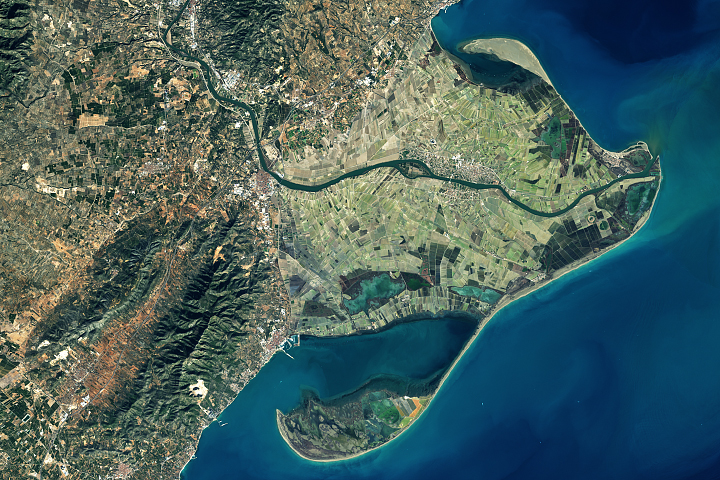
Spain's Ebro Delta has recently experienced tremendous shape-shifting.
Published Mar 13, 2018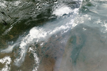
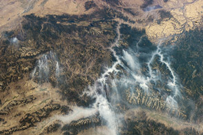
A ribbon of smoke connects two clusters of intense fires in central Russia in this photo-like image from August 12, 2010.
Published Aug 12, 2010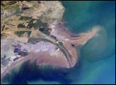
The Yellow River Delta coastline along the Gulf of Bohai has always experienced dramatic changes, and those changes continue today. This mosaic of images taken by astronauts aboard the International Space Station shows several things. First, the image shows today’s configuration of the delta of China’s Yellow River, which is one of the most dynamic coastlines on Earth. Second, the scene allows mapping of land use along the coastal plain, including the boundaries of the Shengli Oil Field, China’s second largest oil field. But perhaps the most interesting aspect of this image is the large patch of green water off the northern coast of the delta—a presumed plankton bloom.
Published Aug 23, 2004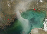
A hazy plume drifted over the northern end of the Caspian Sea in early April 2008. The translucent plume swirling over the water contrasts with the nearby opaque white clouds. The plume might result partly from smoke from springtime agricultural fires in farmland north of the sea.
Published Apr 16, 2008