Images related to Smoke over the U.S. from Spring Burning

Carbon Monoxide Pollution over the United States and Canada
Image

Carbon Monoxide Pollution over the United States and Canada

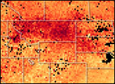
The high carbon monoxide concentrations shown in this satellite-based map reflect the poor air quality seen in the central and eastern United States on June 8, 2011.

Published Jun 10, 2011

Image of the Day Atmosphere Dust and Haze

Smoke from Fires in Russia and Alaska
Image

Smoke from Fires in Russia and Alaska

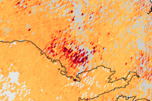
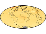
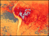
The highest concentrations of carbon monoxide, a component of smoke, are centered over large fire complexes in Russia in this image that tracks smoke transport across the Arctic.

Published Aug 1, 2009

Image of the Day Atmosphere Land Dust and Haze

Carbon Monoxide from Canadian Fires
Image

Carbon Monoxide from Canadian Fires

Published Jul 10, 2006

Dust and Haze

Fires and Thick Smoke over South America
Image

Fires and Thick Smoke over South America

Published Oct 2, 2007

Fires

Smoke over Central America
Image

Smoke over Central America

Published Apr 22, 2005

Dust and Haze

Carbon Monoxide Levels Trace Spread of Smoke Across Canada
Image

Carbon Monoxide Levels Trace Spread of Smoke Across Canada

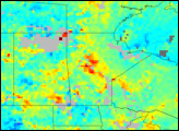
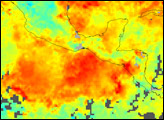
This map shows concentrations of carbon monoxide—one component of smoke—from June 23–28 across Canada and the northern United States.

Published Jul 9, 2010

Image of the Day Atmosphere Dust and Haze

Carbon Monoxide from Wallow Fire
Image

Carbon Monoxide from Wallow Fire

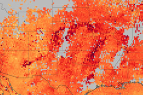
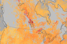
This series of images shows high concentrations of carbon monoxide moving across the United States from the Wallow Fire in eastern Arizona between June 3 and June 6, 2011.

Published Jun 9, 2011

Atmosphere Dust and Haze