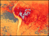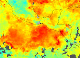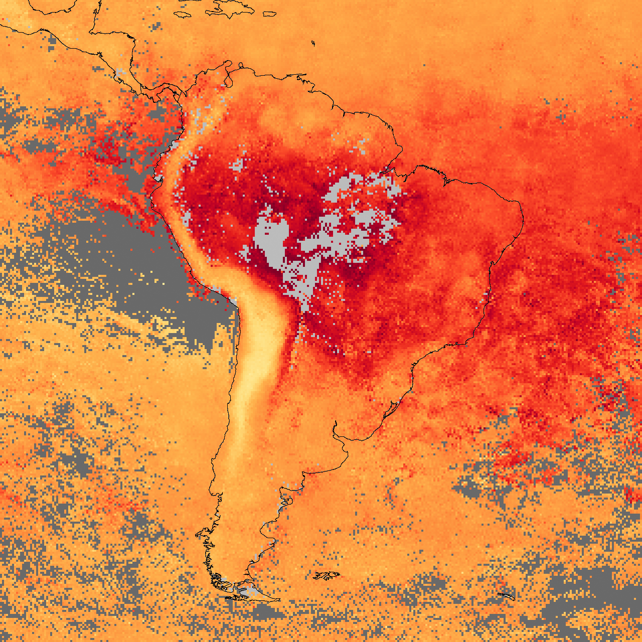
Throughout September 2007, intense fires burned across South America, and the skies were frequently thick with smoke. Carbon monoxide is one of several gases released by burning vegetation. Because of its relatively long lifetime in the atmosphere, carbon monoxide is a good tracer of smoke-related pollution.
This image of the continent shows satellite observations of carbon monoxide for September 2007, measured by the measurements of Pollution in the Troposphere (MOPITT) sensor on NASA’s Terra satellite. The image shows the column density of carbon monoxide, which is the number of molecules of carbon monoxide in a 1-square-centimeter column of the atmosphere. The image shows how the fires have increased carbon monoxide levels over the Amazon Basin (dark red) in the heart of the continent. Along the west coast, the curve of the Andes Mountains is evident in the very low levels of carbon monoxide (yellow area); smoke backed up against the mountains but did not climb to the high altitudes of the peaks. Places where MOPITT could not collect enough data to make an estimate of carbon monoxide (probably due to clouds) are gray. Some smoke apparently spilled westward over the equatorial Pacific Ocean, but a larger amount spread eastward over the Atlantic Ocean.
NASA image created by Jesse Allen, Earth Observatory, using data provided by the National Center for Atmospheric Research (NCAR) and the University of Toronto MOPITT Teams.