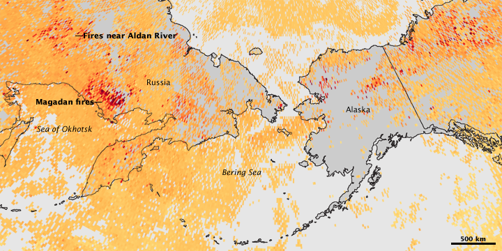


Intense fires burning in the boreal forests of northern Russia, Alaska, and Canada darkened Northern skies with smoke in July 2009. Large fires were burning in both Russia and Alaska in late July, and this image tracks the smoke from those fires by illustrating the concentration of carbon monoxide in the atmosphere.
The image was made with data collected by the Measurements of Pollution in the Troposphere (MOPITT) sensor on NASA’s Terra satellite between July 20 and July 26, 2009. Spots of red show where carbon monoxide concentrations were high, while orange areas point to moderate concentrations. Gray regions indicate places where no measurements were made, probably because of persistent clouds. The highest concentrations of carbon monoxide are centered over large fire complexes in Russia. Fires in Alaska were also pumping carbon monoxide into the atmosphere.
Carbon monoxide is a component of smoke that can be tracked long after the smoke has dispersed enough to no longer be visible. Carbon monoxide helps reveal where smoke’s other invisible fine particles and polluting gases end up. These invisible particles and gases, including carbon monoxide, are ingredients in the production of ground-level ozone, a harmful pollutant.
NASA image created by Jesse Allen, using data provided by the National Center for Atmospheric Research (NCAR) and the University of Toronto MOPITT Teams. Caption by Holli Riebeek.