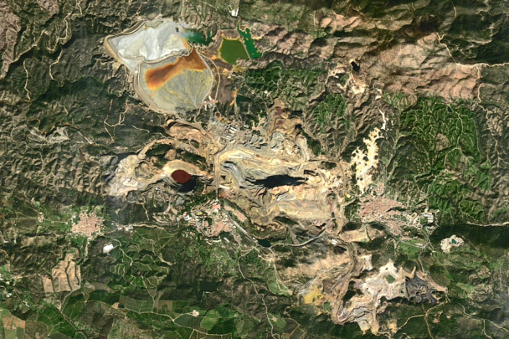
The unusually red and acidic Rio Tinto harbors microscopic life that could inform the search for life on Mars.
Published Oct 30, 2020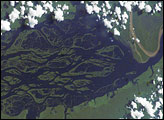
The wide, multi-island zone in the Rio Negro (Black River) shown in this astronaut photograph from September 2, 2006, is one of two, long “archipelagoes” upstream of the city of Manaus (not shown) in central Amazonia. Sixty kilometers of the total 120-kilemeter length of this archipelago appear in this image.
Published Dec 4, 2006
Corrientes, Argentina (sits on the east bank of the Paraná River, South America’s third largest river. Corrientes is located just inside Argentina, across the river from the southwestern tip of Paraguay.
Published Nov 8, 2004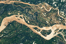
The Paraná River is South America’s second largest, and an important transportation route for landlocked cities in Argentina, Paraguay, Bolivia, and Brazil.
Published May 2, 2011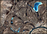
This false-color image from April 1, 2002, shows numerous braided channels and oxbow lakes along the Songhua River in northeastern China, just upstream of the city of Harbin.
Published Dec 27, 2005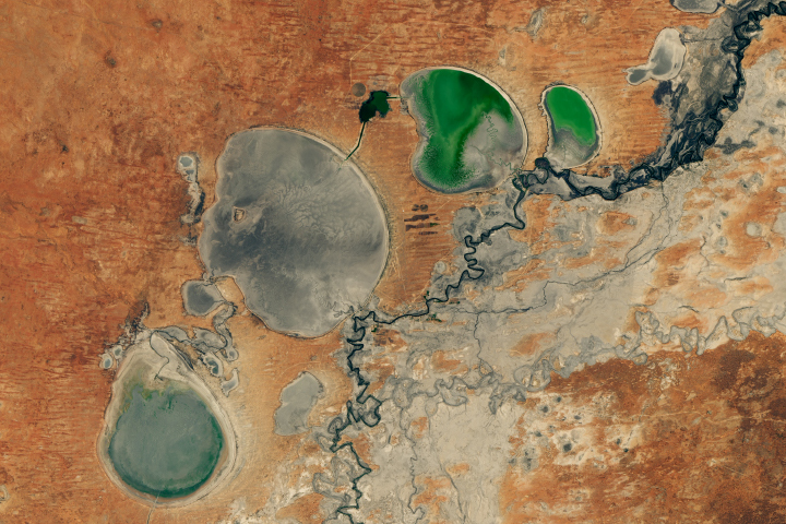
The Menindee Lakes in New South Wales are facing extremely low water levels.
Published Feb 26, 2019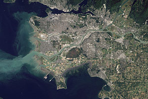
Flowing past the city of Vancouver, the Fraser River delivers a thick plume of sediment to the Strait of Georgia.
Published Mar 14, 2012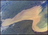
Rio de la Plata is the muddy estuary of the Paraná and Uruguay Rivers, and forms part of the border between Argentina and Uruguay. The rich estuary supports both capital cities of Buenos Aires and Montevideo. This image provides a snapshot of the complicated mixing in the Rio de la Plata between the fresh river waters and the water of the South Atlantic.
Published Dec 8, 2003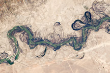
Acquired September 30, 2010, this astronaut photograph shows part of the Syr Darya River Floodplain in Kazakhstan, where the river flows through braided channels.
Published Nov 1, 2010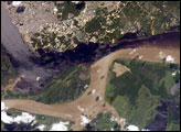
The largest river on the planet, the Amazon, forms from the confluence of the Solimões (the upper Amazon River) and the Negro at the Brazilian city of Manaus in central Amazonas. At the river confluence, the muddy, tan-colored waters of the Solimões meet the “black” water of the Negro River. The unique mixing zone where the waters meet extends downstream through the rainforest for hundreds of kilometers, and is a famous attraction for tourists from all over the world. The tourism contributes to substantial growth in the city of Manaus. Twenty years ago the large park near the city center (center) lay on the eastern outskirts of Manaus.
Published Feb 12, 2005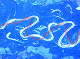
The Mamore River drains north from the Andes Mts. in lowland Bolivia. An image taken in July 2003 from the International Space Station (ISS007-E-10797, 14 June 2003, 12:36 GMT) shows an 85 km stretch of the river south of the lowland town of Trinidad in the Beni Province. Numerous changes in river pattern are visible in the decade since Landsat imagery of the same area was acquired.
Published Aug 18, 2003
Trees have long been cherished here for timber and for the colors they bring to “the Fall Rhapsody.”
Published Oct 24, 2020
Sections of Australia have been experiencing their worst drought in 100 years. Astronauts aboard the International Space Station documented conditions in Australia in 2002, including these images of Lake Tandou in the Menindee Lake system along the Darling River. The Menindee Lakes are part of an innovative water conservation project. This lakebed is protected from flooding and is used for agriculture—primarily cotton, sunflower and grains. It is one of several interconnected lakes that sit along the lower Darling River like a string of pearls. Other lakes function as water capture reservoirs to support controlled water flow for environmental and agricultural needs down river, and to provide flood mitigation.
Published Dec 1, 2002