Acquired August 30, 2009, this true-color image shows hotspots and smoke associated with the Station Fire in Los Angeles County. The hotspots remain west of Mt. Wilson, the site of critical communication centers.
Published Sep 1, 2009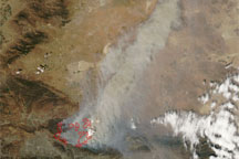
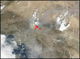
Acquired August 31, 2009, this true-color image shows the spreading Station Fire north of Los Angeles. Hotspots from the fire almost reach Mt. Wilson Observatory.
Published Aug 31, 2009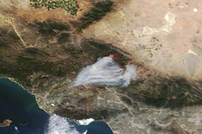
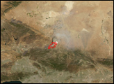
A wildfire burned in steep terrain north of Los Angeles near Palmdale on May 31, 2013.
Published Jun 3, 2013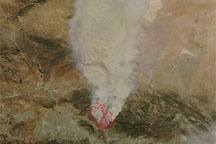
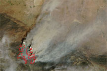
Acquired on the afternoon August 29, 2009, this image shows fires burning north of the city of Los Angeles. Hotspots associated with the fire correspond with the Station and Morris fires described by the California Department of Forestry and Fire Protection.
Published Aug 30, 2009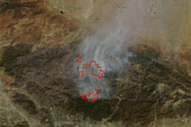
Acquired September 6, 2009, this true-color image shows reduced smoke and scattered hotspots associated with the Station Fire in Los Angeles County.
Published Sep 7, 2009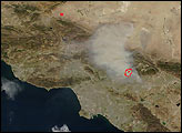
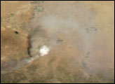
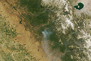
On June 17, 2013, NASA’s Terra satellite captured this image of the Carstens fire burning southwest of California’s Yosemite National Park.
Published Jun 19, 2013