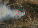
This image shows the extent of Arizona’s Wallow Fire on June 15, 2011.
Published Jun 16, 2011
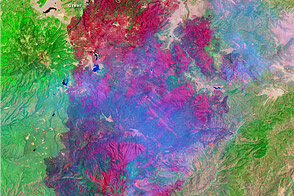
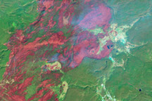
In August 2013, the Silver Fire burned 20,000 acres near Banning, California.
Published Aug 14, 2013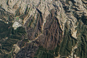
Satellite images show the extent of a destructive fire that burned thousands of homes in the picturesque seaside city.
Published May 7, 2014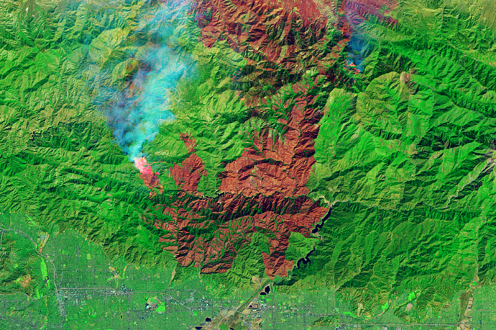
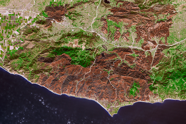
The fire is among the largest Los Angeles County has ever faced.
Published Sep 23, 2020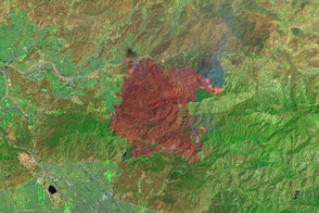
False-color images reveal the hot spots and charred land left behind by the fire.
Published Jul 25, 2016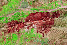
This false-color image shows the brick-red burn scar left behind by the Guiberson Fire in Ventura County, California, on September 26, 2009.
Published Sep 28, 2009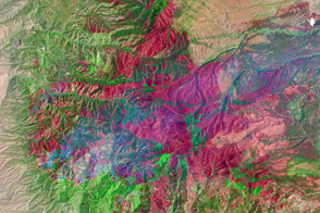
The Whitewater-Baldy Fire is the largest on record in New Mexico.
Published Jun 14, 2012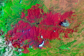
The EO-1 satellite observed the burn scar from the Little Bear Fire.
Published Jun 14, 2012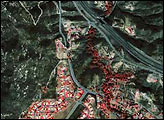
In 1988, wildfires raced through Yellowstone National Park, consuming hundreds of thousands of acres. This series of Landsat images tracks the landscape’s slow recovery through 2008.
Published Jul 1, 2009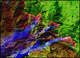
As the destructive California fire nears full containment, it has left behind an expanse of charred land.
Published Nov 19, 2018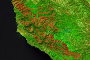
Burning since late July, the Soberanes fire in California has left an extensive mark on the landscape.
Published Sep 21, 2016