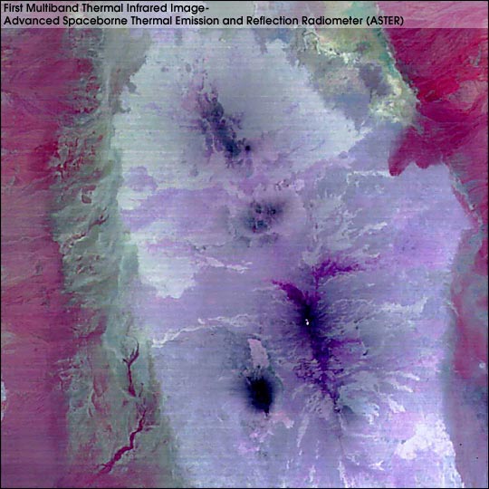


This ASTER thermal-infrared composite image, the first high spatial resolution multispectral thermal infrared data from satellite, is of an area in the Afar Triangle in the Eritrea/Red Sea region. It shows color variations which are mainly due to rock and soil composition differences; temperature differences are expressed as brightness variations. Areas shown in the red hues on the left and right sides are probably underlain by rocks with high silicon-dioxide content, whereas those areas appearing white and lavender in the central part are a more mafic composition, dominantly basaltic lava flows and cinder cone deposits. The dark areas within the complex of basaltic rocks are mainly domes, which are highly fractured. The multispectral thermal-infrared capability of ASTER will permit compositional determinations that are not possible in the shorter wavelength regions. The ten very bright pixels in the lower center of the image show high temperatures of molten lava in the summit crater of the active Erta Ale volcano.
(The size of image: 60km x 60km approx., ground resolution 90m x 90m approx. A decorrelation stretch was applied to bands 10, 12 and 14 in blue, green and red respectively.)
For more images from the Terra instruments, see the Terra Web Site
Image courtesy of MITI, ERSDAC, JAROS, and the U.S./Japan ASTER Science Team