The Earth Observatory has published its last Image of the Day on this website. Please join us on our new home at science.nasa.gov/earth/earth-observatory.
Weeks of rain caused devastation in the Philippines in January 2011. On January 18, Voice of America reported that 53 people had died, and more than a dozen remained missing. On January 17, Agence France-Presse reported that 8,800 people had taken shelter in evacuation centers, and at least 1.5 million had been affected by the floods in some way.
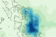
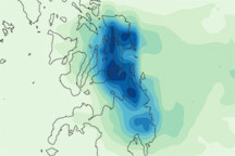
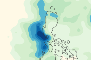
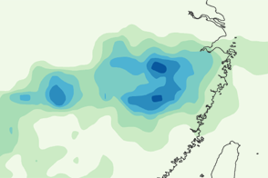
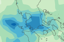
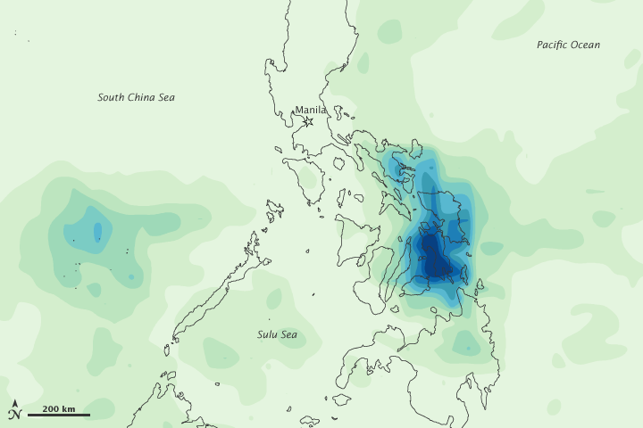
This map shows rainfall amounts over the Philippines from January 12 to 18, 2011. The heaviest rainfall—more than 900 millimeters (35 inches)—appears in dark blue. The lightest rainfall—less than 100 millimeters (4 inches)—appears in light green.
The heaviest rain is concentrated along the eastern seaboard. Voice of America reported that more rain was forecast for that area over the next several weeks, and had the potential to exacerbate the situation on the ground.
Amid the destruction, some encouraging news emerged for the Pacific nation, according to Agence France-Presse. On January 19, the World Bank announced a $1.5 million grant to bolster Manila’s flood defenses. Torrential rains killed hundreds in the capital city in 2009.
This image is based on data from the Multisatellite Precipitation Analysis produced at NASA’s Goddard Space Flight Center, which estimates rainfall by combining measurements from many satellites and calibrating them using rainfall measurements from the Tropical Rainfall Measuring Mission (TRMM) satellite.
NASA Earth Observatory image by Jesse Allen, using near-real-time data provided courtesy of TRMM Science Data and Information System at Goddard Space Flight Center. Caption by Michon Scott.