

Heavy rains, flash floods, and landslides in the Philippines had affected more than 450,000 people and killed at least 18 by January 5, 2011, the United Nations reported. The Associated Press reported that nearly 13,000 residents had sought refuge in emergency shelters. Casualties resulted from drowning, burial by landslides, and electrocution.
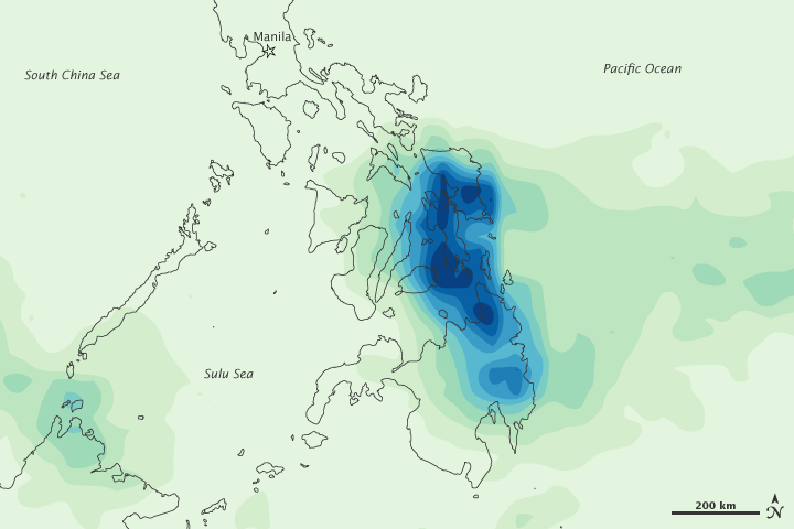
This image shows rainfall over the Philippines from December 30, 2010, to January 5, 2011. The heaviest rainfall—more than 900 millimeters or 35 inches—appears in dark blue. The lightest rainfall—less than 100 millimeters or 4 inches—appears in light green. The heaviest precipitation is concentrated along the eastern coasts, southeast of Manila.
In early September 2010, the United Nations reported that the Philippines could face a strong storm season resulting from La Niña conditions. La Niña generally intensifies rainfall over the Philippines, Indonesia, Malaysia, and northern Australia.
This image is based on data from the Multisatellite Precipitation Analysis produced at NASA’s Goddard Space Flight Center, which estimates rainfall by combining measurements from many satellites and calibrating them using rainfall measurements from the Tropical Rainfall Measuring Mission (TRMM) satellite.
NASA Earth Observatory image by Jesse Allen, using near-real-time data provided courtesy of TRMM Science Data and Information System at Goddard Space Flight Center. Caption by Michon Scott.