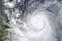


At noon Central Daylight Time on September 17, 2010, the U.S. National Hurricane Center reported that Hurricane Karl had made landfall about 10 miles (15 kilometers) north of Mexico’s port city of Veracruz. A Category 3 hurricane, Karl had maximum sustained winds of 115 miles (185 kilometers) per hour. The Los Angeles Times reported that high winds toppled trees and billboards along the coast, but for many residents, the storm’s worst hazard was rain.
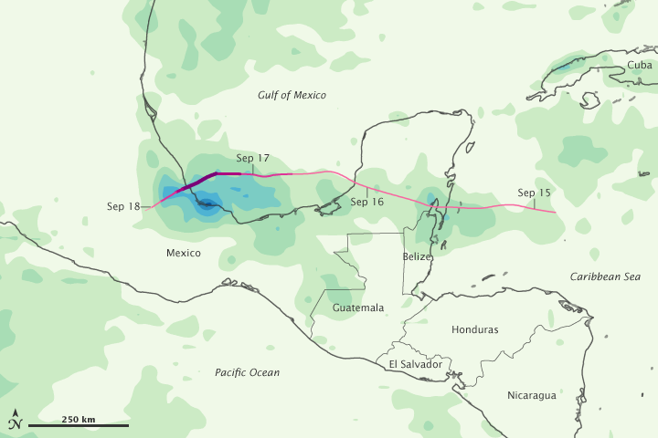
This color-coded image shows rainfall amounts in southern Mexico and Central America from September 14 to 18. The heaviest rainfall amounts—300 millimeters or nearly 12 inches—appear in dark blue. The lightest amounts—50 millimeters or less than 2 inches—appear in light green. A storm track is superimposed on the rainfall amounts, and the track’s color shows Karl’s intensity at each location. Pink indicates a tropical depression and dark purple indicates a Category 3 storm.
High rainfall amounts occurred along Karl’s entire path, but especially heavy rain occurred over the coast of Mexico, immediately south of the storm track. Even before Karl approached, southern Mexico was already contending with one of its wettest seasons on record. Floods and landslides resulting from Hurricane Karl only added to the hardship. On September 22, 2010, the BBC reported that the number of deaths attributable to Karl had risen to 15.
This image is based on data from the Multisatellite Precipitation Analysis produced at Goddard Space Flight Center, which estimates rainfall by combining measurements from many satellites and calibrating them using rainfall measurements from the Tropical Rainfall Measuring Mission (TRMM) satellite.
NASA Earth Observatory image by Jesse Allen, using near-real-time data provided courtesy of TRMM Science Data and Information System at Goddard Space Flight Center. Caption by Michon Scott.
Image of the Day Atmosphere Land Severe Storms
This color-coded map shows the rainfall and storm track associated with Hurricane Karl from September 14 to 18, 2010.
Image of the Day for September 24, 2010
Hurricane Karl strengthened to a major hurricane on September 17, 2010, as it approached the Gulf Coast of Mexico.

