The Earth Observatory has published its last Image of the Day on this website. Please join us on our new home at science.nasa.gov/earth/earth-observatory.
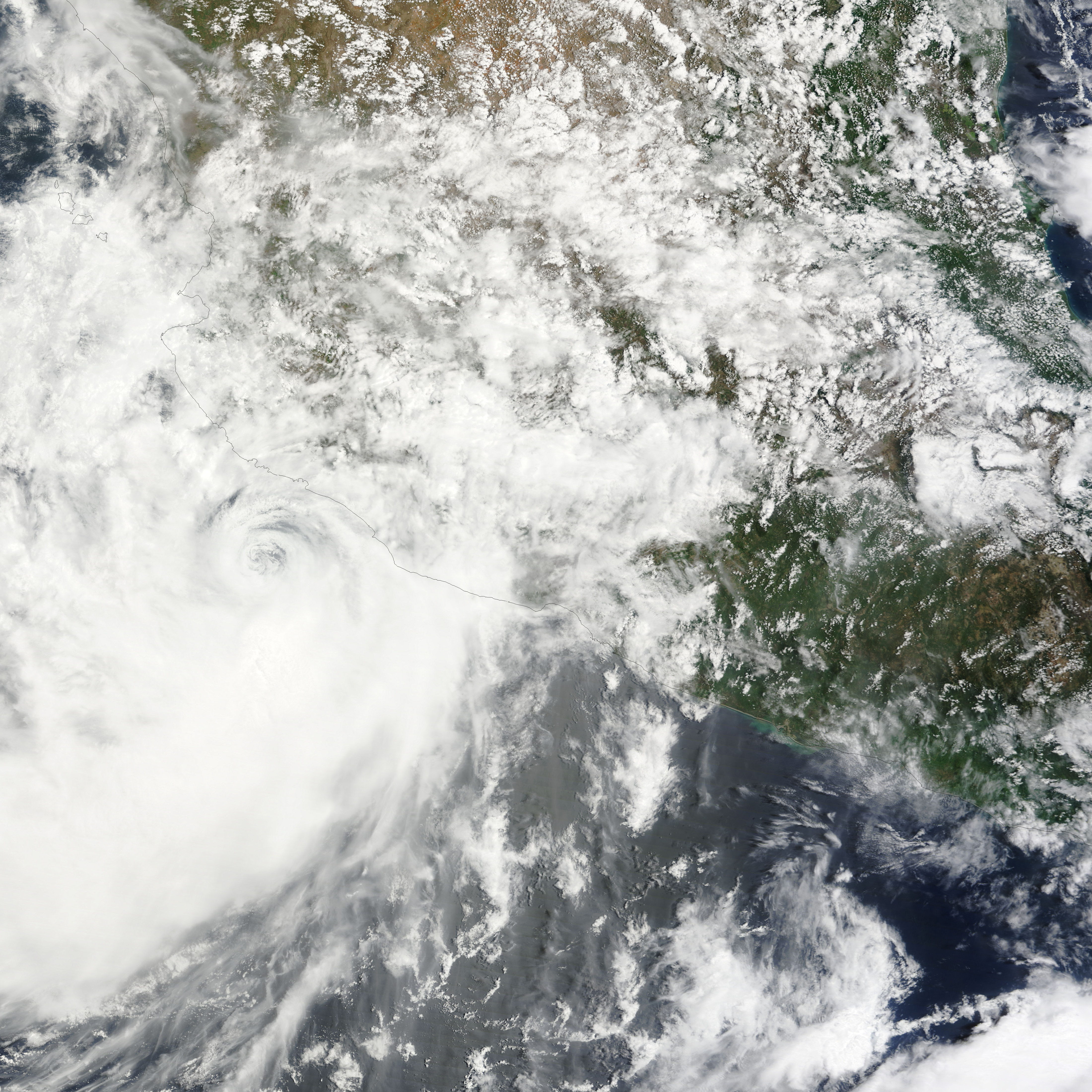
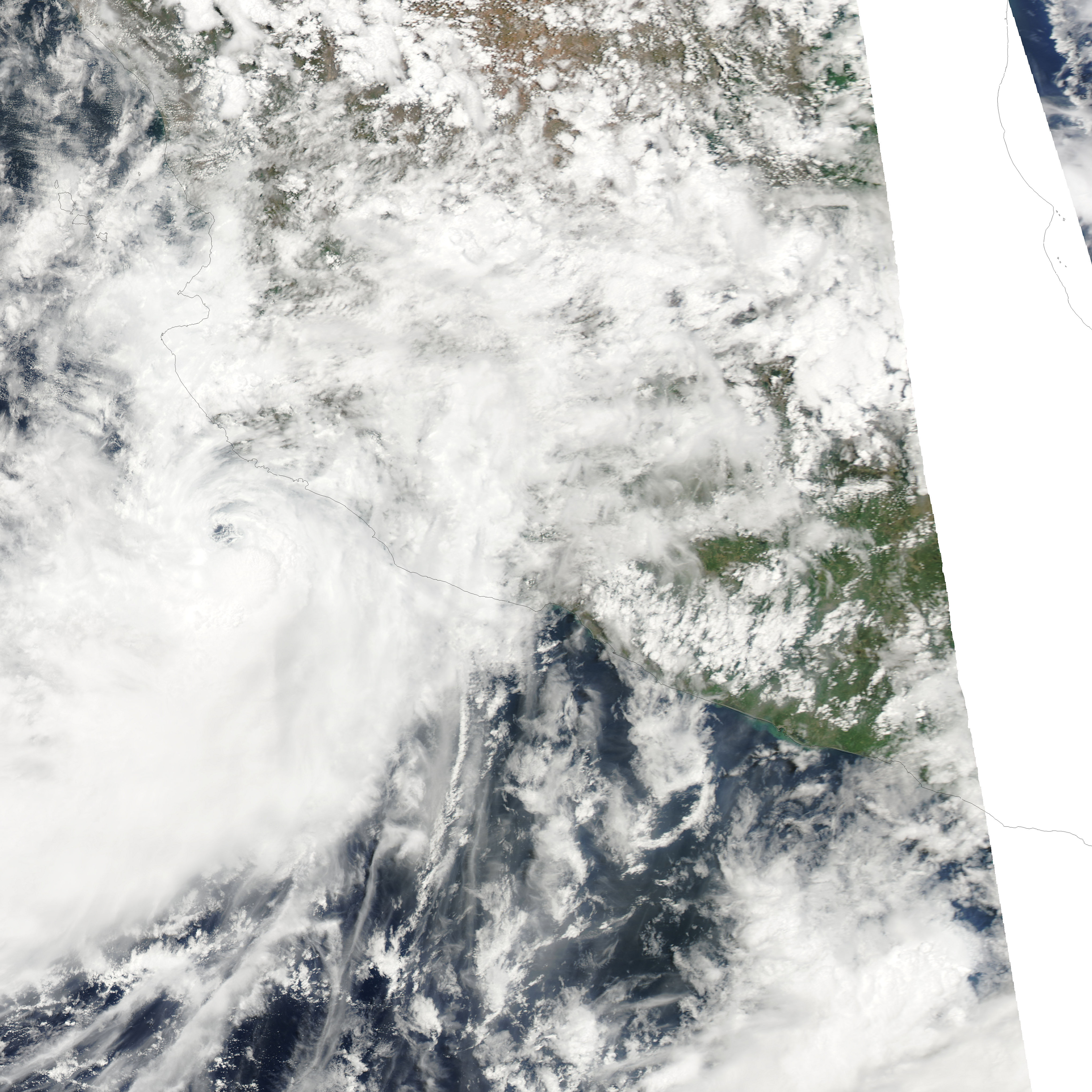
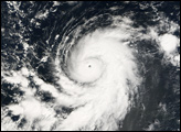
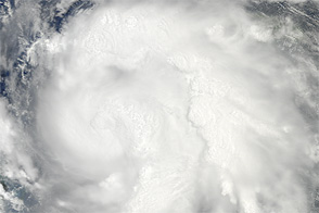
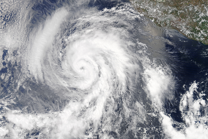
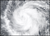
Tropical Storm Andres, the first named storm of the eastern Pacific hurricane season fired up in mid-June 2009. This pair of images from the Moderate Resolution Imaging Spectroradiometer (MODIS) sensors on NASA’s Terra and Aqua satellites shows Andres at 10:35 a.m. U.S. Pacific time (top) and again at 1:45 p.m. (bottom) on June 23, just prior to the National Hurricane Center’s 2:00 p.m. public advisory warning that Andres had become a hurricane.
During the time when the storm was intensifying, the eye of the storm moved northwest (compare its location to the coastal city of Manzanillo from one image to the next). The eye was more open, and the clouds surrounding it appeared more loosely organized at the time of the Terra MODIS image. By the time Aqua MODIS captured the second image, the eye seemed more compact. A well-formed, compact eye is one indicator of a storm’s strength.
For residents of the East Coast of North America, it can seem like all hurricanes make a beeline for land, but it is typical for eastern Pacific storms to head away from shore. The prevailing winds in the area are the easterly trade winds; in the absence of other strong weather patterns, the winds will generally steer tropical storms west or northwest. As of 8:00 a.m. on June 24, the National Hurricane Center reported that Andres, which had weakened back to tropical depression status, was heading northwest at 9 miles per hour, and they predicted it would continue on that path until it dissipated later that day or that night.
NASA image courtesy the MODIS Rapid Response Team. Caption by Rebecca Lindsey.