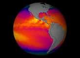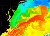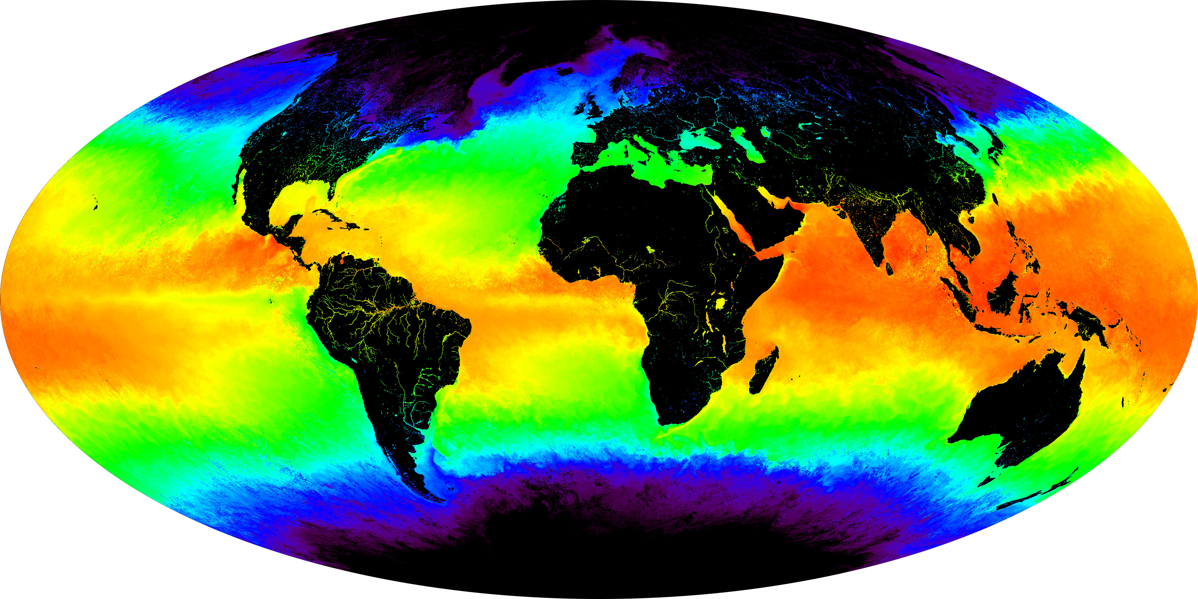
Every day the Moderate-resolution Imaging Spectroradiometer (MODIS) measures sea surface temperature over the entire globe with high accuracy. This false-color image shows a one-month composite for May 2001. Red and yellow indicates warmer temperatures, green is an intermediate value, while blues and then purples are progressively colder values. The new MODIS sea surface temperature product will be particularly useful in studies of temperature anomalies, such as El Niño, as well as research into how air-sea interactions drive changes in weather and climate patterns.
In the high resolution image, notice the amazing detail in some of the regional current patterns. For instance, notice the cold water currents that move from Antarctica northward along South America's west coast. These cold, deep waters upwell along an equatorial swath around and to the west of the Galapagos Islands. Note the warm, wide currents of the Gulf Stream moving up the United States' east coast, carrying Caribbean warmth toward Newfoundland and across the Atlantic toward Western Europe. Note the warm tongue of water extending from Africa's east coast to well south of the Cape of Good Hope.
MODIS was launched in December 1999 aboard NASA's Terra satellite. For more details on this and other MODIS data products, please see NASA Unveils Spectacular Suite of New Global Data Products from MODIS.
Image courtesy MODIS Ocean Group, NASA GSFC, and the University of Miami