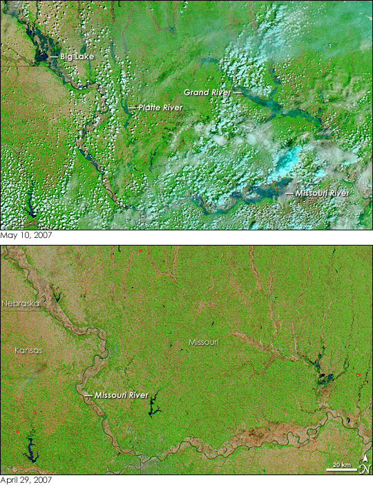
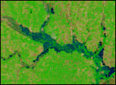
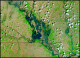
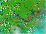
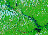
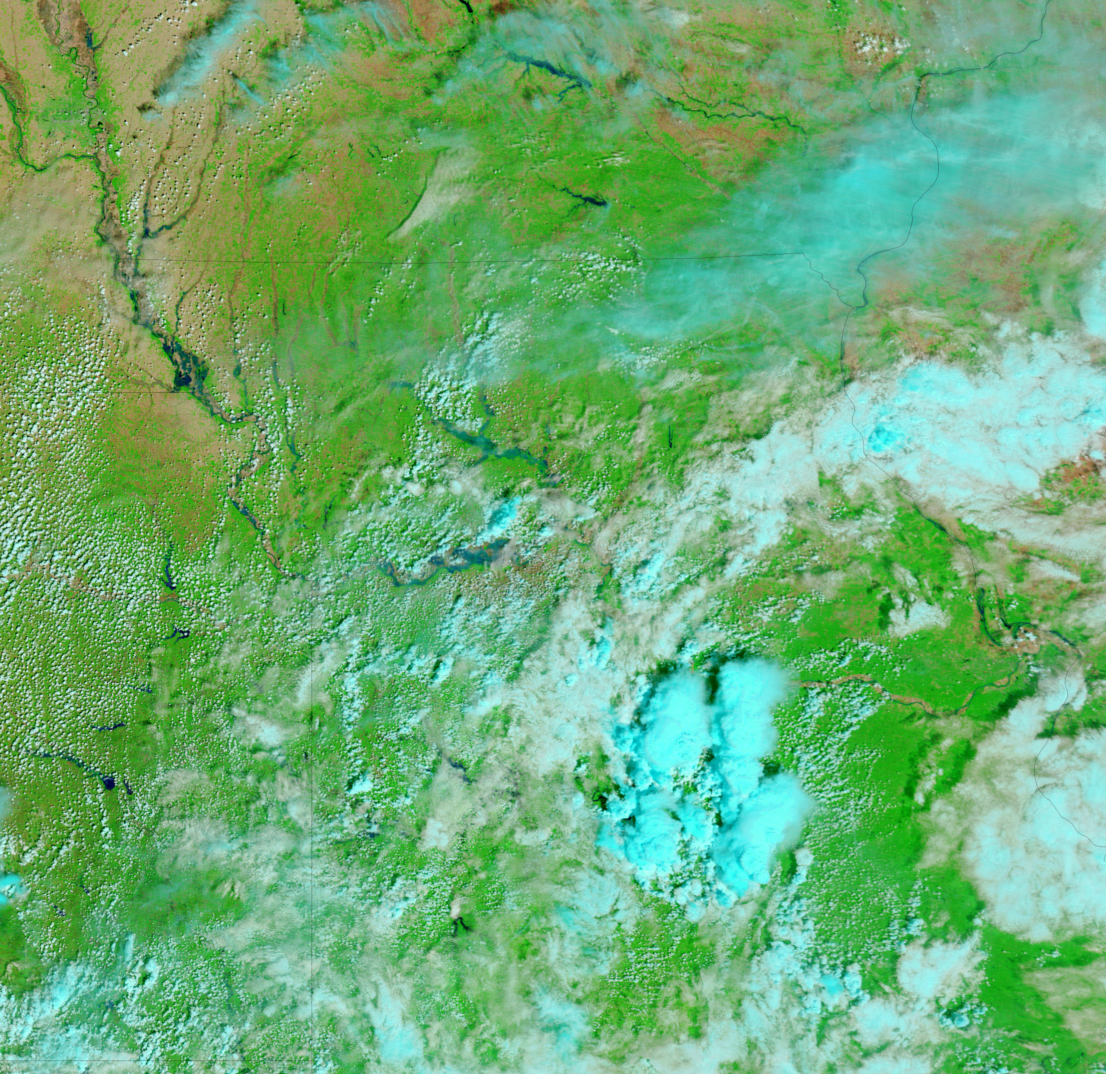
The rivers of northwestern Missouri were still swollen in the wake of intense spring storms when the Moderate Resolution Imaging Spectroradiometer (MODIS) on NASA’s Terra satellite captured the top image on May 10, 2007. The image is made from a combination of infrared and visible light to make the floods more visible than they would be in a photo-like image. In this type of image, water is dark blue or black, clouds are light blue and white, plant-covered land is bright green, and bare earth is pink-tinted tan. Fires are outlined with red boxes.
The Missouri River runs along the left edge of the image, then curves east along the bottom of the image. Though the most flooded regions were covered in clouds, a few breaks reveal that the Missouri was swollen far beyond its banks. Nestled in a bend in the river near the Nebraska, Kansas, and Missouri border is the town of Big Lake. The image shows that the river’s curve has turned into a broad lake. The town was completely submerged in the flood when levees along the river broke, reported the Associated Press. Beyond Big Lake, many communities along the Grand and the Platte Rivers and their tributaries have also been flooded or threatened by floods. All of these rivers are clearly running high in the image.
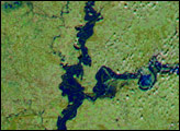
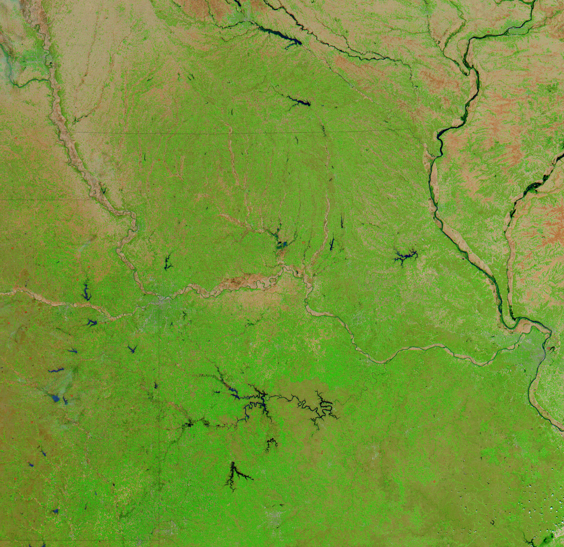
MODIS captured the lower image on April 29, 2007, not quite a week before the rains began. By providing a clear view of normal water levels, the image illustrates just how extensively the rivers were flooded on May 10. Photo-like versions of both the April 29 and May 10 images are available from the MODIS Rapid Response System.
NASA images courtesy the MODIS Rapid Response Team at NASA GSFC.


