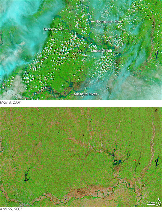
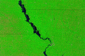
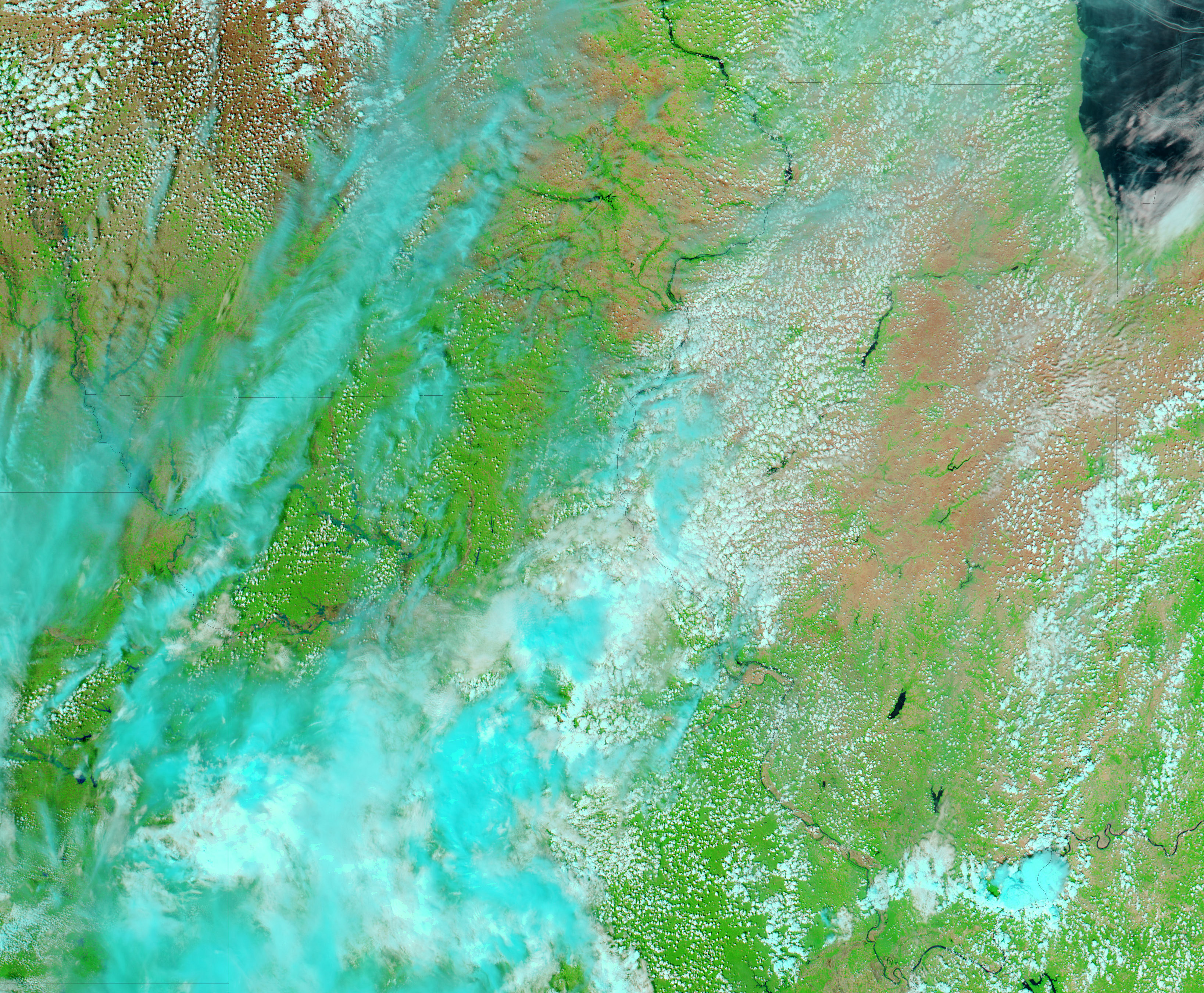
Early May 2007 brought torrential spring rains to the Midwestern United States, and by May 9, the National Weather Service had recorded flooding at 111 locations from North Dakota to Texas. At 15 locations, many of which were in Missouri, gauges measured major flooding. Thousands of people fled as the Missouri burst through levees in Missouri and Kansas, reported the Associated Press on May 9.
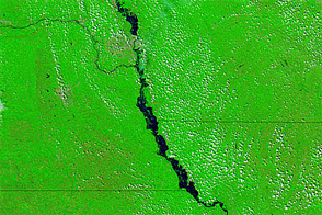
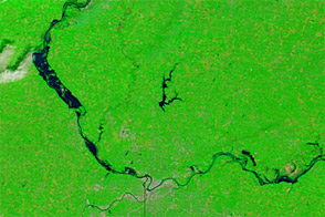
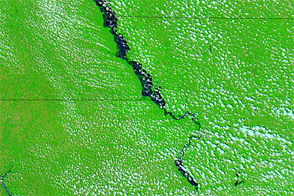
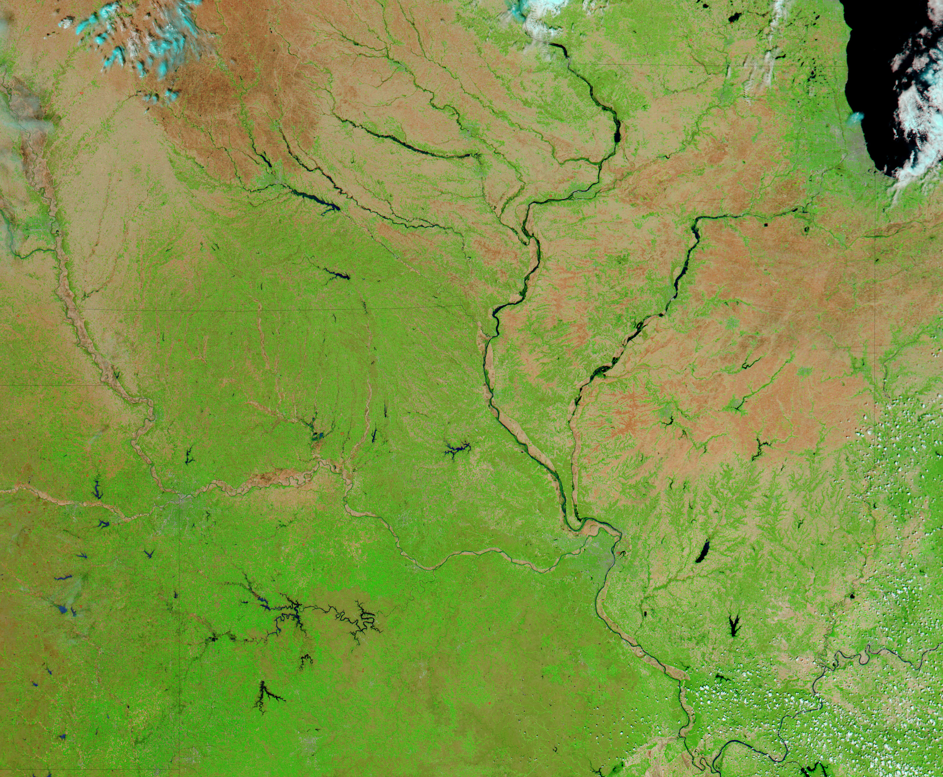
The Moderate Resolution Imaging Spectroradiometer (MODIS) on NASA’s Aqua satellite captured the top image of floods along the Missouri River and its tributaries on May 8. Though clouds still covered much of the Midwest on May 8, a few breaks revealed the flood-swollen Missouri, Grand, and Thompson Rivers. The large image shows additional flooding in Missouri, Iowa, and Kansas. Both this and the lower image, taken on April 29 before the rains began to fall, were made with a combination of visible and infrared light to highlight the presence of water on the ground. In this type of image, clouds are pale blue and white, water is dark blue or black, plant-covered land is green, and bare earth is tan pink. The tan and green speckled appearance of the landscape seen in the lower image is typical of agricultural land. Daily images of the Midwest are available from the MODIS Rapid Response System.
NASA images courtesy the MODIS Rapid Response Team at NASA GSFC.


