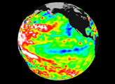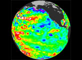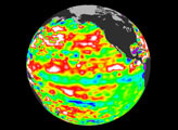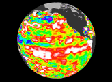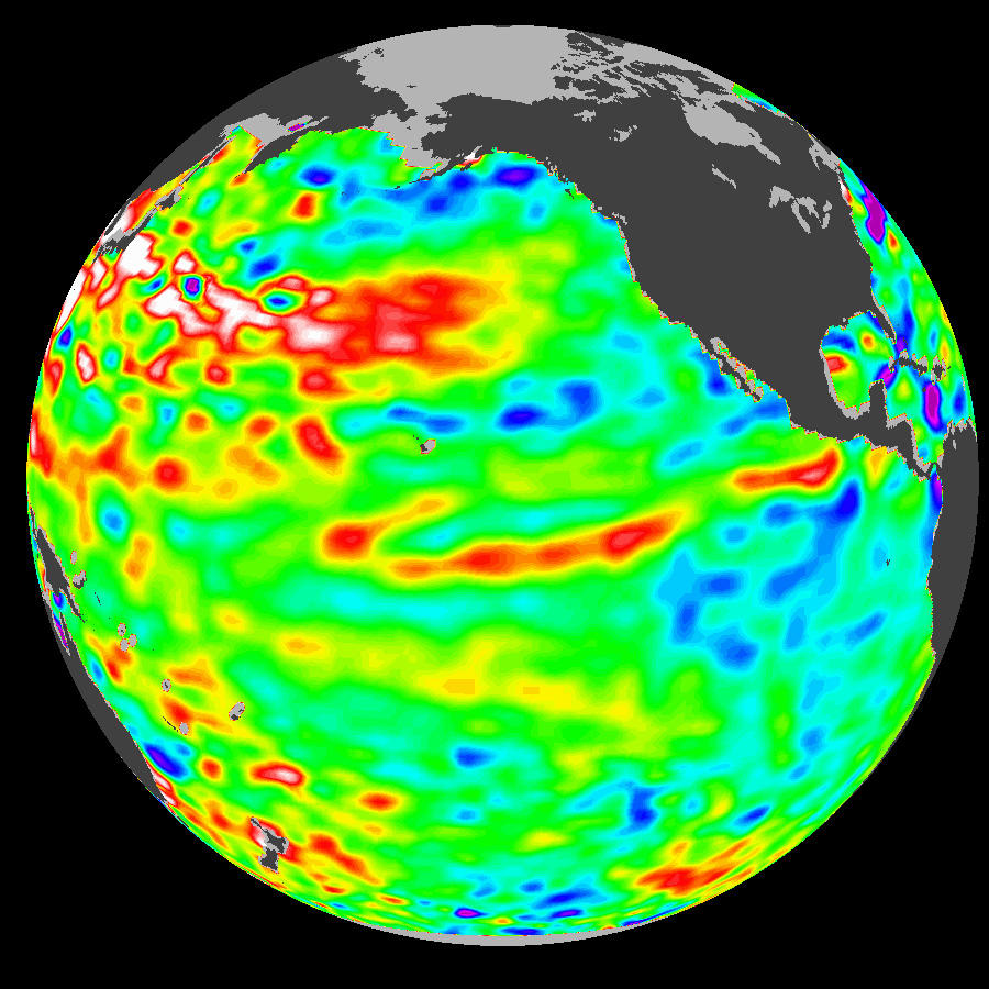
These data, taken during a 10-day collection cycle ending August 18 by the TOPEX-Poseidon mission, 2001, show that above-normal sea-surface heights and warmer ocean temperatures (indicated by the red and white areas) still blanket the far-western tropical Pacific and much of the north (and south) mid-Pacific. Red areas are about 10 centimeters (4 inches) above normal; white areas show the sea-surface height is between 14 and 32 centimeters (6 to 13 inches) above normal.
This build-up of heat dominating the Northern and Western Pacific was first noted by Topex/Poseidon oceanographers almost three years ago and has outlasted the El Niño and La Niña events of the past few years. (See http://www.jpl.nasa.gov/elnino/990127.html.) This warmth contrasts with the Bering Sea, Gulf of Alaska and Eastern tropical Pacific where lower-than-normal sea levels and cool ocean temperatures continue (indicated by blue areas). The blue areas are between 5 and 13 centimeters (2 and 5 inches) below normal, whereas the purple areas range from 14 to18 centimeters (6 to 7 inches) below normal. Across the tropics, the equatorial ocean remains calm with no indication of any El Niño developing.
Looking at the entire Pacific basin, the Pacific Decadal Oscillation’s warm horseshoe in the North and West Pacific and cool wedge pattern in the Eastern Tropical Pacific still dominates this sea-level height image. Most recent National Oceanic and Atmospheric Administration sea-surface temperature data also clearly illustrate the persistence of this basin-wide pattern. They are available at http://psbsgi1.nesdis.noaa.gov:8080/PSB/EPS/SST/climo.html.
Image Courtesy Topex Poseidon Team, NASA JET Propulsion Lab and the Centre National d’Etudes Spatiales