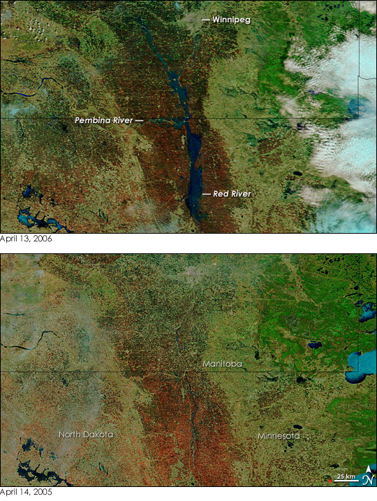


Major flooding swamped the Red River on April 13, 2006, and the National Weather Service issued flood warnings for most communities that lined either side of the river. As the floods swept north into Canada, Winnipeg was bracing for the inundation, expected to peak around April 20. Along the border between the United States and Canada, the Pembina River was also swollen. Flooding at the confluence of the two rivers was nearing its peak when the Moderate Resolution Imaging Spectroradiometer (MODIS) on NASA’s Terra satellite took the top image. The Red River spanned several kilometers in North Dakota and Minnesota in contrast to the thin blue line it formed during the same period in 2005 (lower image). The floods were caused by snow melt and rain. For official flood forecasts and warnings, please visit the National Weather Service.
The large images provided above have a resolution of 500 meters per pixel. Daily images are available from the MODIS Rapid Response Team in a variety of resolutions, including MODIS’ maximum resolution of 250 meters per pixel.
NASA images courtesy the MODIS Rapid Response Team at NASA GSFC.